Tropical Storm Hilary Potentially Impacting Southern California Beginning Sunday 20 August.
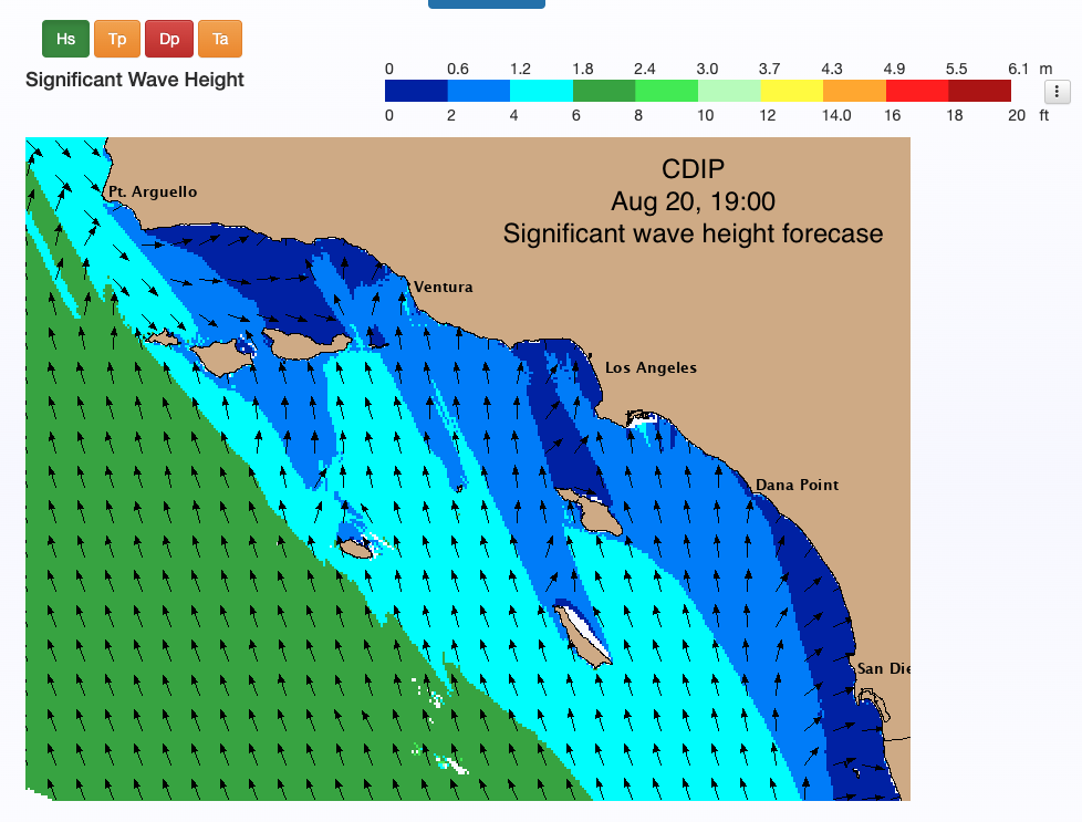
We are tracking the wave height with the Coastal Data Information Program (CDIP) three-day forecast below.
The Coastal Process Group at the Center for Coastal Studies is also tracking wave forecasts and flooding at validated site locations in Southern California including Malibu, Will Rogers, Huntington Beach, Cardiff Beach, Torrey Pines, Naval Base Coronado, and Imperial Beach.
The Center for Western Weather and Water Extremes (CW3E) is also providing regular updates.
- The disturbance that was located off the coast of Southern Mexico in the Pacific was upgraded to Tropical Storm Hilary today, 16 Aug 2023
- Tropical Storm Hillary is forecast to become a hurricane tomorrow, 17 Aug 2023, and continue strengthening
- The storm is expected to impact the Baja Peninsula and Southern California, with Tropical Storm force winds likely to reach the Baja sometime late Friday to early Saturday and reach Southern California mid to late Sunday per the most recent NHC forecast
- There is potential for heavy precipitation accompanying the high winds across much of Southern California as a result of the elevated moisture levels forecasted to be brought into the region by Hilary
- A predecessor rain event (PRE) is forecast to occur north of Hilary on Saturday into Sunday, bringing heavy rainfall to the southwestern US, fed by of tropical moisture from Hilary
- Stay alert to official NWS forecasts, watches, and warnings from the National Hurricane Center at nhc.noaa.gov, information from local NWS weather forecast offices at weather.gov, and follow guidance from local emergency management officials