Table of Contents
ToggleLetter from the Director
Download the Strategic Plan: Click Here
It is a PLEASURE to unveil the Southern California Coastal Ocean Observing System (SCCOOS) five-year strategic vision and reflect on how far we have come in almost twenty years of development. SCCOOS now supports 22 principal investigators at 10 institutions and is continuing to grow by earning trusted partners. Our relevance is stronger than ever as coastal change requires organizations to be responsive, flexible, and adaptive. Already, 2023 has delivered challenges to the ocean in the form of coastal flooding in the wake of a barrage of atmospheric rivers. Climate experts predict more such extreme events, which for California also means more drought and wildfires. We know droughts are intensifying with each year, and we all recognize the role of global climate and coupled oceanic-atmospheric processes on trends like this in the terrestrial sphere. Latitudinal differences in ocean heating and upwelling may also be linked to the meridional changes in fire potential across the West. All this complexity creates an environmental mise en scène that gives us whiplash when trying to decide what ocean observing to prioritize – from the physical to the organismal. With all this distraction and funding-driven fatigue, it is easy to overlook the human capital that makes SCCOOS successful. Without the tireless scientists and engineers at SCCOOS, we would not be able to adequately observe the ocean and produce the model forecasts that our community depends upon. I like to remind the world that “scientists are people too,” and without the resilient members of the Integrated Ocean Observing System (IOOS), we would not be nearly so successful, creative, or adaptive. As an IOOS Regional Association director, I think one of my most important jobs is building and nurturing relationships with not only the public and decision-makers who rely on our data and products, but with the dedicated people who choose to advance ocean science and technology rather than apply their talents elsewhere.
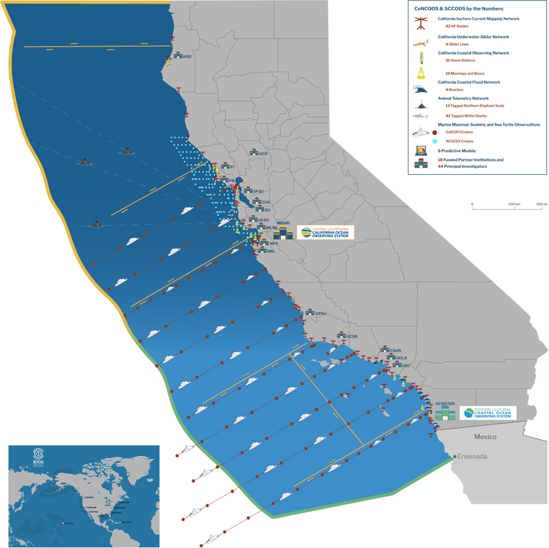
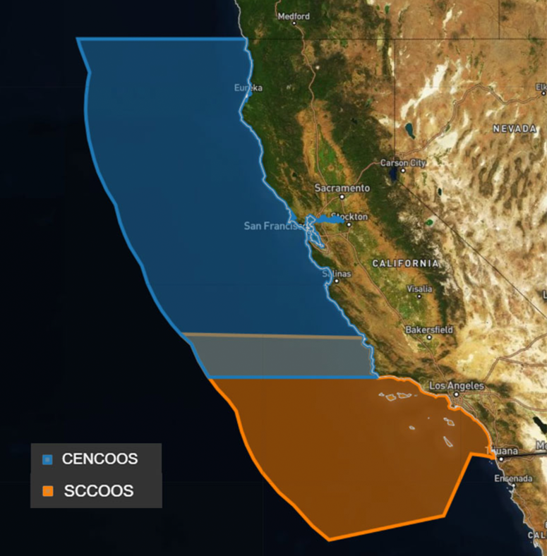
Relationship-building is so fundamental to what we do that I see it play out every day in terms of the SCCOOS role in real-life events and emergencies. In a time-sensitive situation, first responders tend to lean on their intimate familiarity with a group like SCCOOS. When Los Angeles Sanitation and Environment was faced with a challenging episode concerning a discharge breach, the leadership immediately turned to SCCOOS because of history producing timely and impartial analysis of events with High-Frequency Radar derived surface current data. California public health officials directly consult SCCOOS for harmful algal bloom information as a result of consistent data delivery as well as the frequent collaboration that builds camaraderie. Importantly, our strong partnership with the Central and Northern California Ocean Observing System (CeNCOOS) allows us to accomplish more with our IOOS funding than we could separately and build strategies to best meet the needs of the State of California.
Personal relationships and trust build a stronger ocean observing system. As we think about how to make the SCCOOS community better reflect our diverse communities, I urge us to make togetherness and conversation a central tenet of ocean observing.
Here’s to the next five years of challenges and growth!
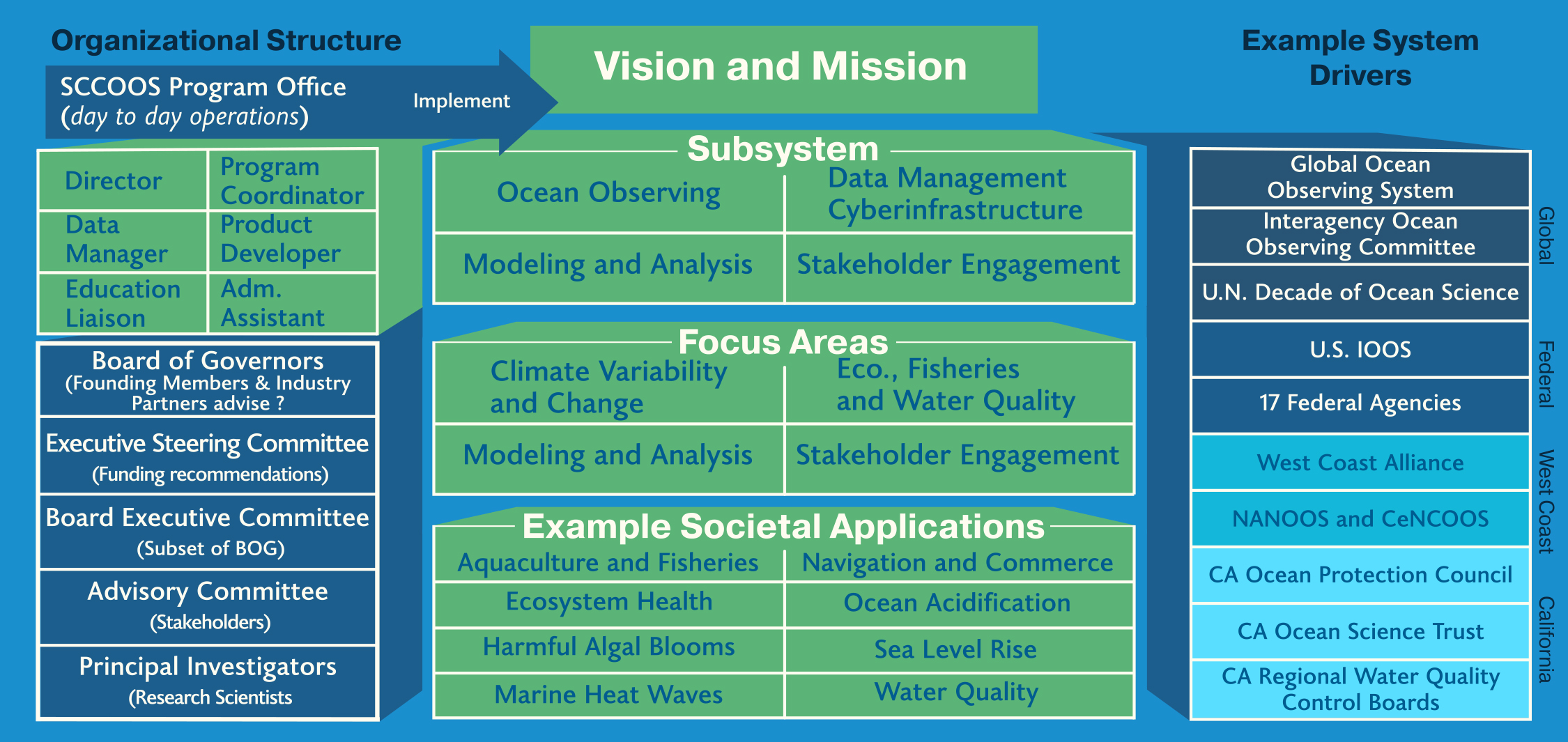
Clarissa Anderson, Ph.D. Vision, Mission,
and Focus Areas
OCEAN VISION
A healthy and prosperous California coastal ocean maintained by information solutions.
MISSION
To produce, integrate, and communicate sustained high-quality, science-based information to promote coastal ocean safety, resilience, and sustainability for all members of society.
FOCUS AREAS
- Marine Operations
- Coastal Hazards
- Ecosystems, Fisheries, and Water Quality
- Climate Variability and Change
Subsystems
OCEAN OBSERVING
sustains long-term, high-quality observations of the coastal ocean and ecosystems to address SCCOOS regional stakeholder needs.
DATA MANAGMENT AND CYBERINFRASTRUCTURE
delivers standardized, reliable, and accessible data to the public.

MODELING AND ANALYSIS
supports model prediction that address a wide range of user requirements and public needs.
STAKEHOLDER ENGAGEMENT
increases the reach and efficacy of SCCOOS through partnership and collaborative discourse.

SCCOOS at a Glance
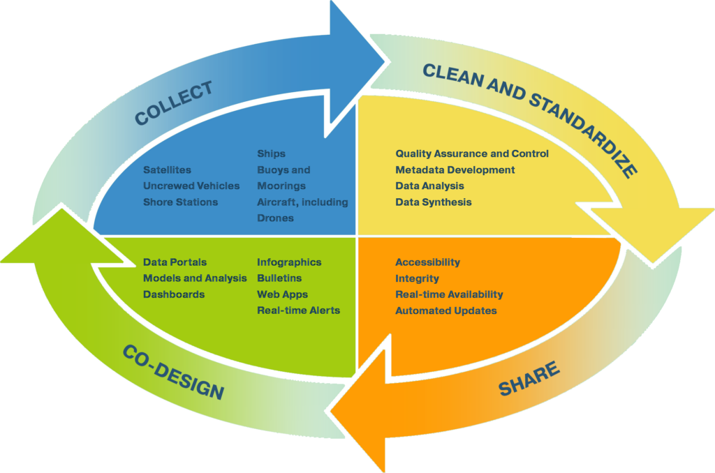
SCCOOS is a network of experts and research teams working together to collect, generate, and aggregate coastal ocean data, forecasts, and products
SCCOOS employs a variety of in situ and remote sensing technologies to measure physical, chemical, biological, and geological parameters. SCCOOS also supports ocean models and provides forecasts of future conditions.
How We Work
SCCOOS was formed in 2004 as a consortium of scientists who recognized the need to provide oceanographic observations and model products to a diverse regional stakeholder community in Southern California.
Building Communities
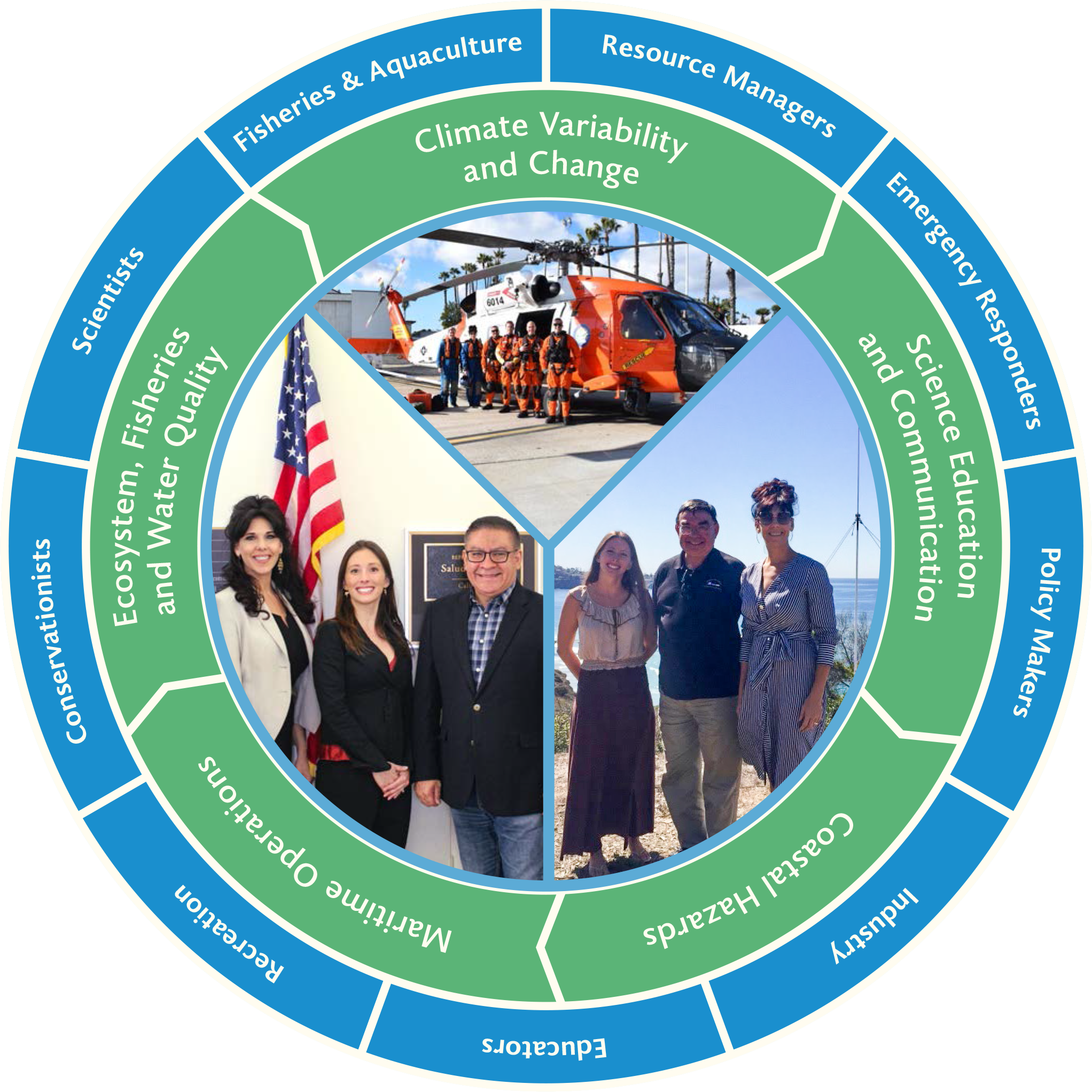
Engage diverse stakeholders and communities and enhance collaboration across state, federal, and industry partnerships to develop innovative ocean observations and information products
Fostering the Next Generation of Ocean Leaders
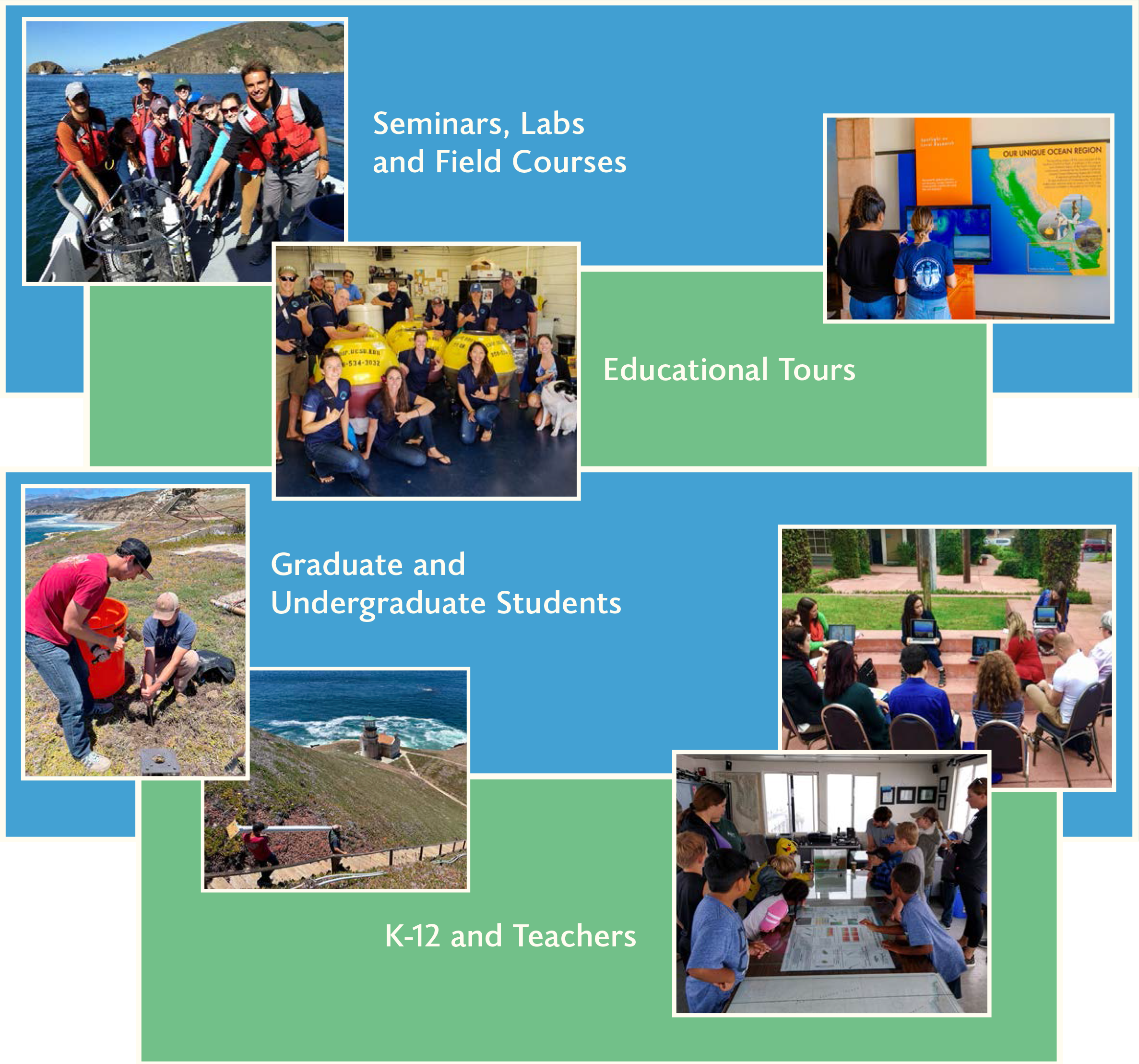
Participate in community outreach and targeted collaborations to inspire and advance education, training, and research opportunities
Data for Societal Benefit
Generate and disseminate accessible, user-driven, curated data visualizations and tools to support decision-making and respond to environmental issues and seasonal hazards
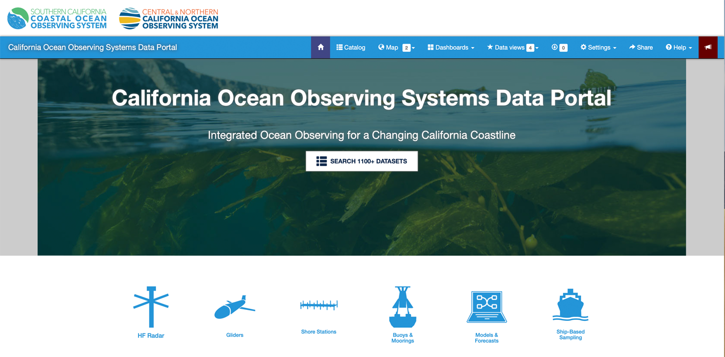
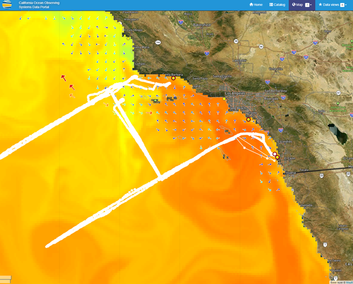
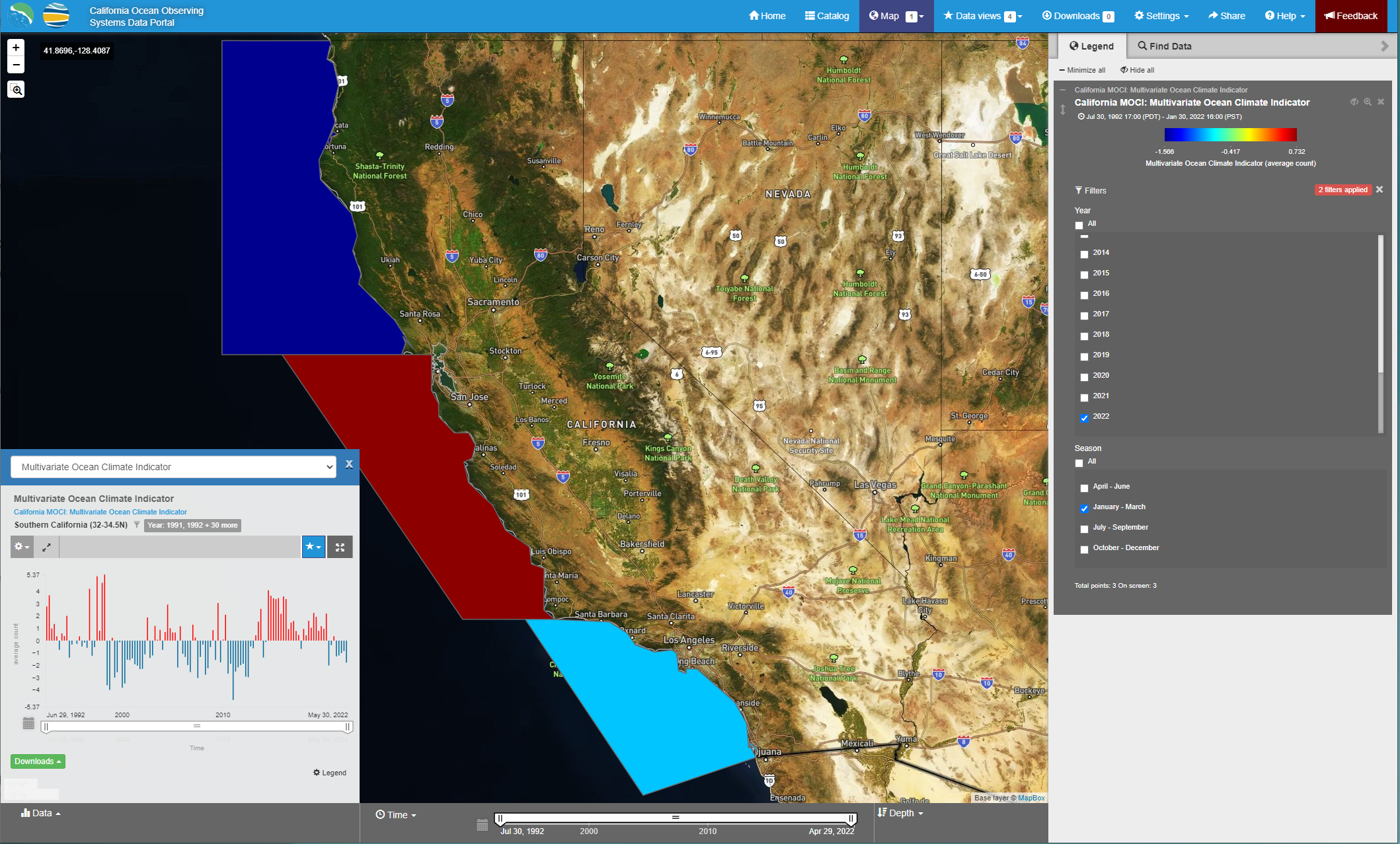
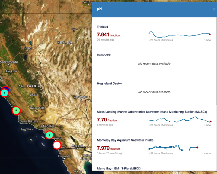
CalOOS, California Ocean Observing Systems Data Portal—data.caloos.org
Strengthen Data Stewardship
Maintain SCCOOS cyberinfrastructure and promote Findable, Accessible, Interoperable, and Reusable (FAIR) data
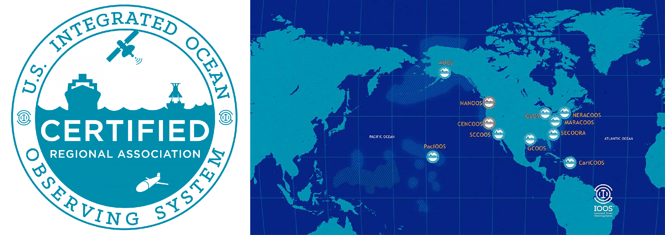
In December 2016, IOOS certified SCCOOS as a Regional Coastal Observing System (RCOS). Certification is a key milestone to the establishment of the full IOOS system and is mandated in the Integrated Coastal and Ocean Observation System Act of 2009 (ICOOS Act). Certification means that SCCOOS is providing high-quality observations to national-level standards and extending the reach and efficacy of Federal programs.
Search and Rescue
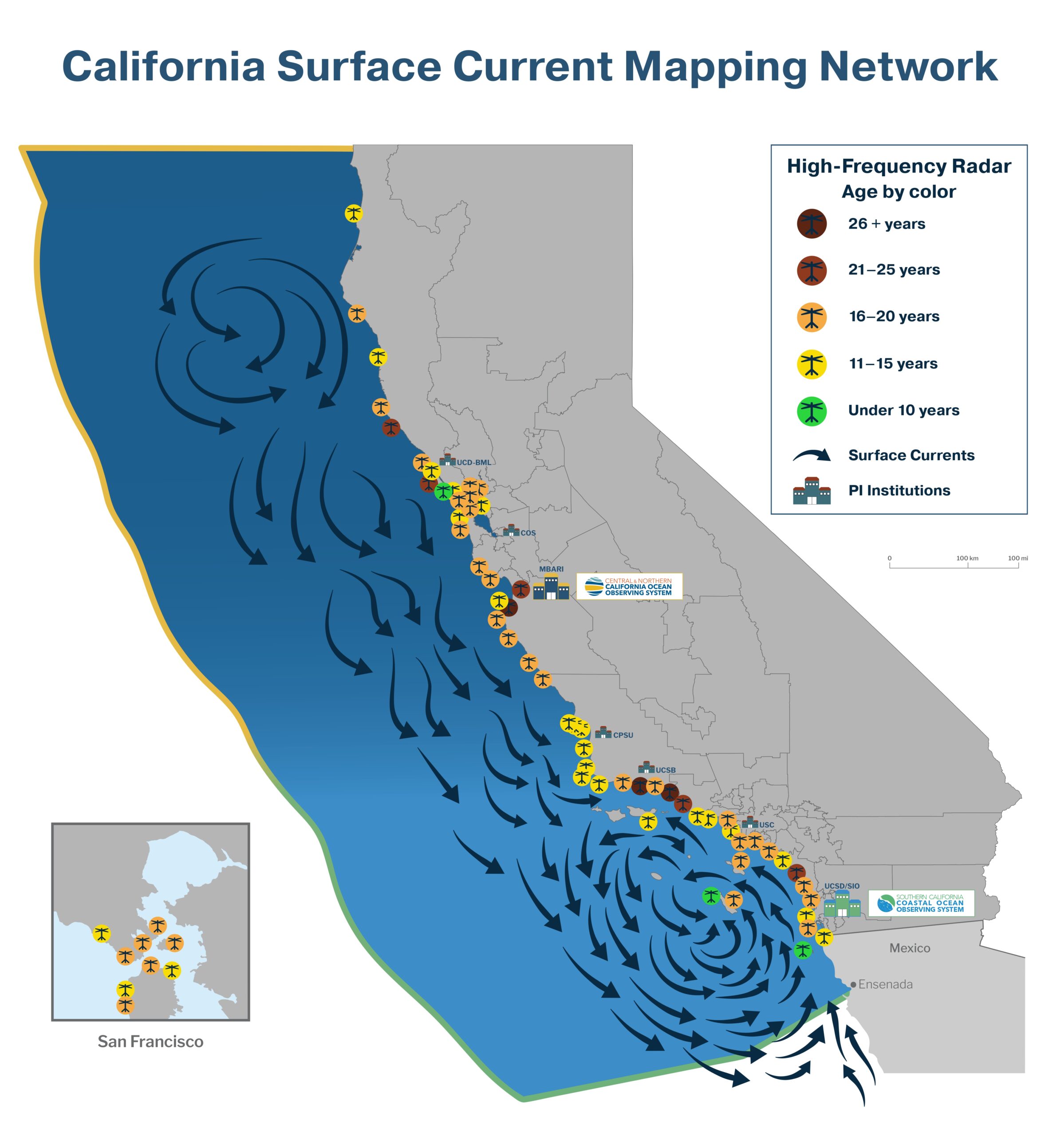
Operate, sustain, and expand the California Surface Current Mapping Network
High-Frequency Radar
(HFR)
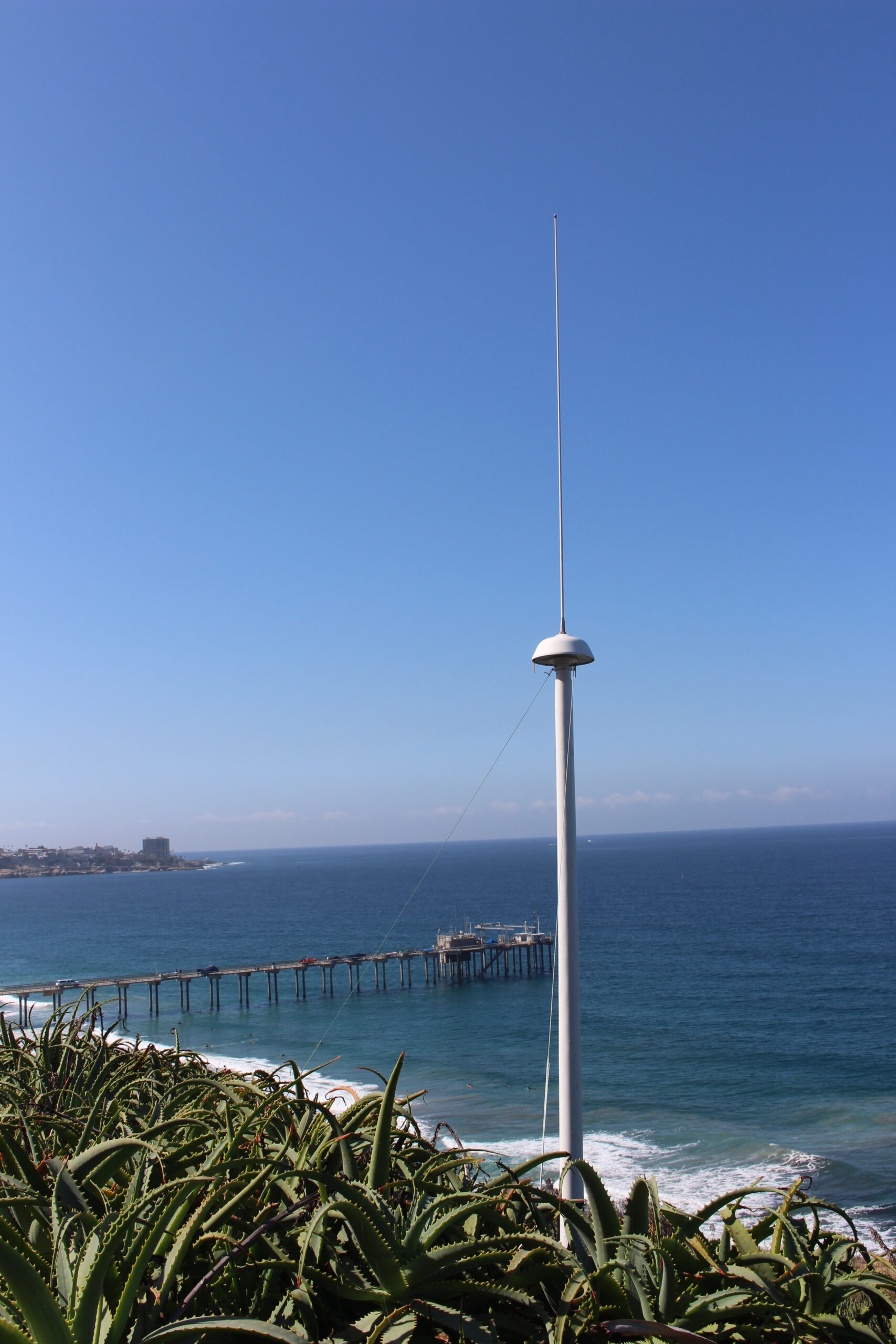
Location:
Scripps Institution
of Oceanography
The Short Term Prediction System (STPS) and the West Coast Operational Forecast System (WCOFS), which rsely on IOOS High-Frequency Radar-derived surface currents to produce forecasts, are invaluable products for the US Coast Guard Search and Rescue. Both these products are vital to support the USCG's Search and Rescue mission of saving lives.
— Dr. Cristina Forbes, Oceanographer, United States Coast Guard, Office of Search and RescueUnder Keel Clearance Project in Support of the New Blue Economy
Improve local swell models at ports, such as the Ports of Los Angeles and Long Beach, to deliver customized information to ships and harbor pilots
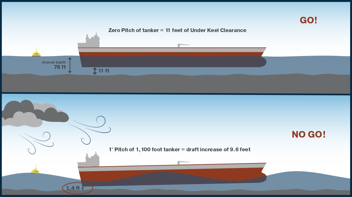
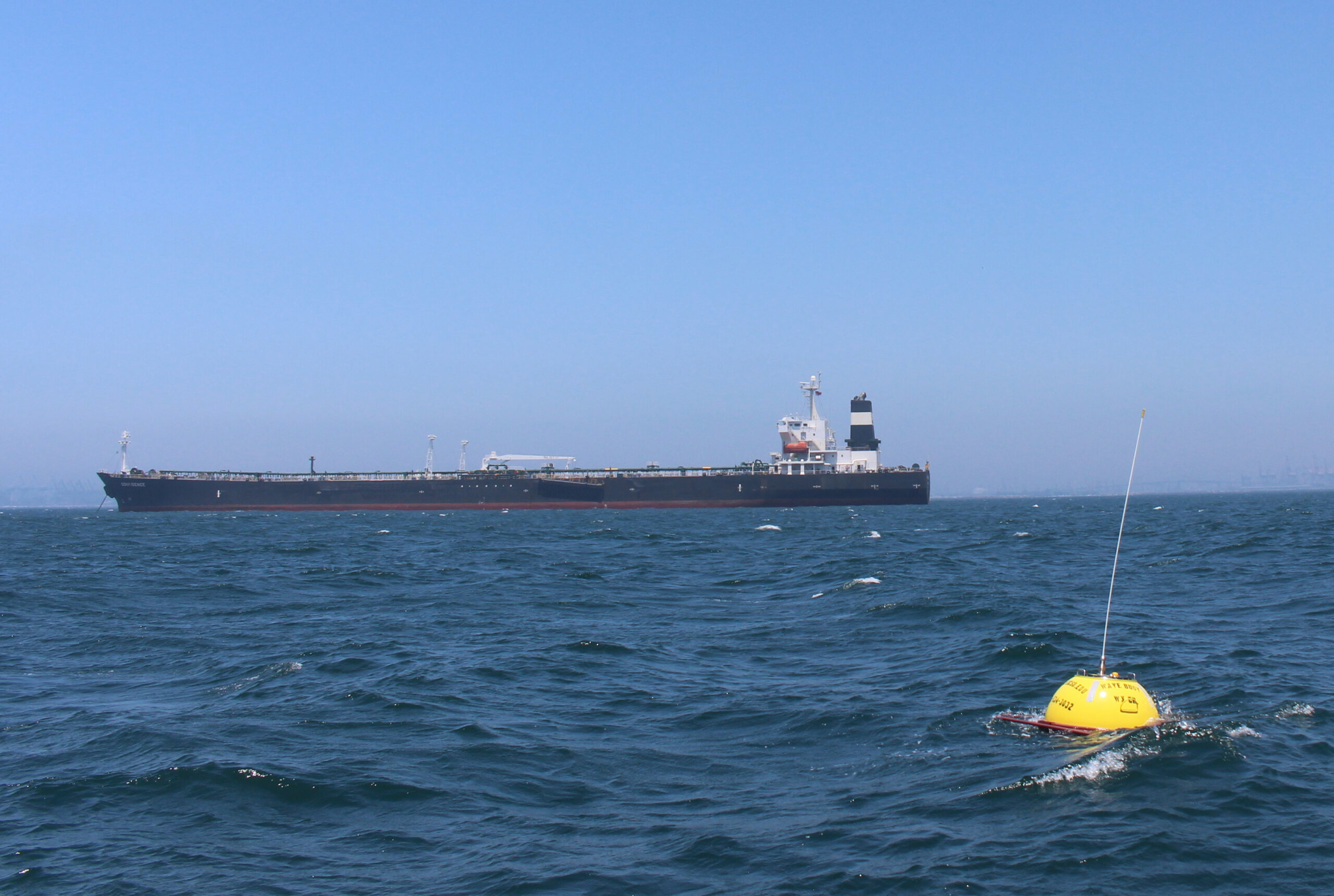
The data provided by SCCOOS from the Coastal Data Information Program (CDIP) buoy and wave model are critical inputs to the Under Keel Clearance Project, which continues to increase safety by reducing risks of transporting oil on the West Coast and into the Port of Long Beach. The UKC project increases efficiency by enabling tankers to meet arrival times to enter port, and to reduce emissions while enabling tankers to carry more oil per arrival.
—Captain J. Kip Louttit, Executive Director, Southern California Marine ExchangeOil Spill Response and Recovery
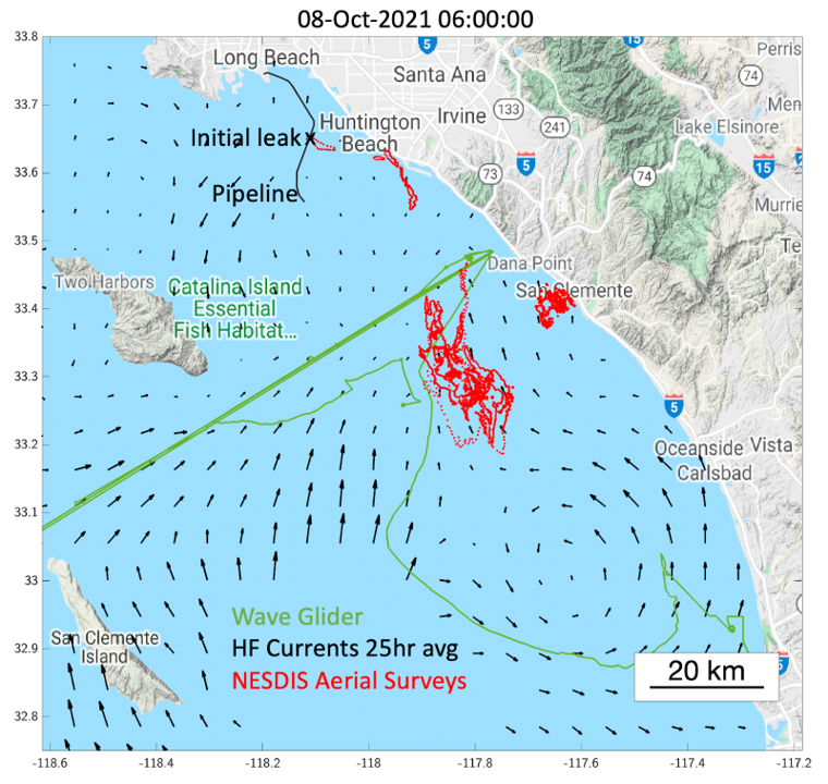
Support HFR derived surface currents and models to track oil slicks and shoreline impacts
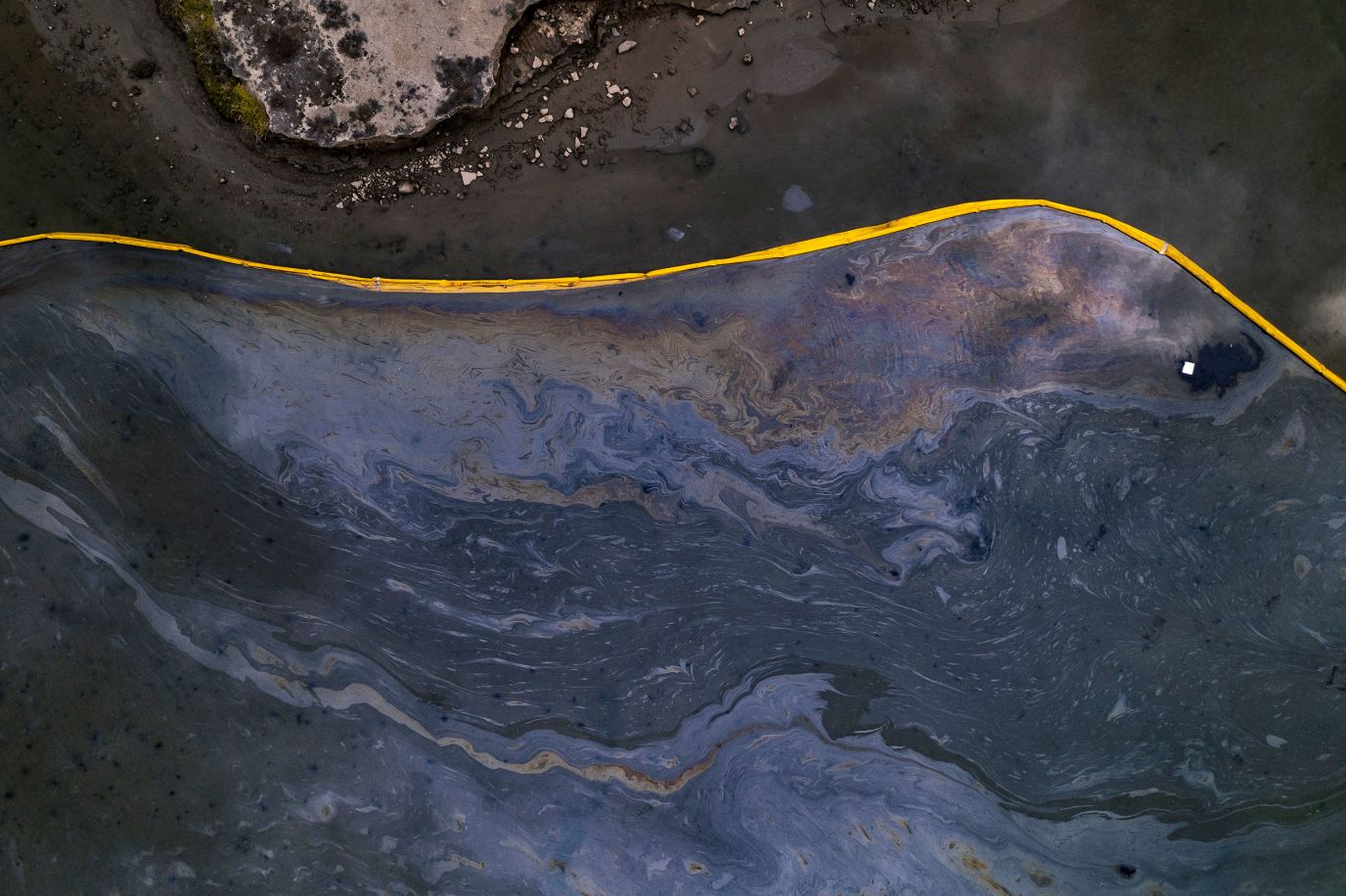
2021 Huntington Beach Oil Spill—On October 2, 2021 25,000 gallons of oil were released from a displaced undersea pipeline off of Huntington Beach, CA. Pictured: a boom was used to contain the oil spill in Talbert Marsh, Huntington Beach, CA.
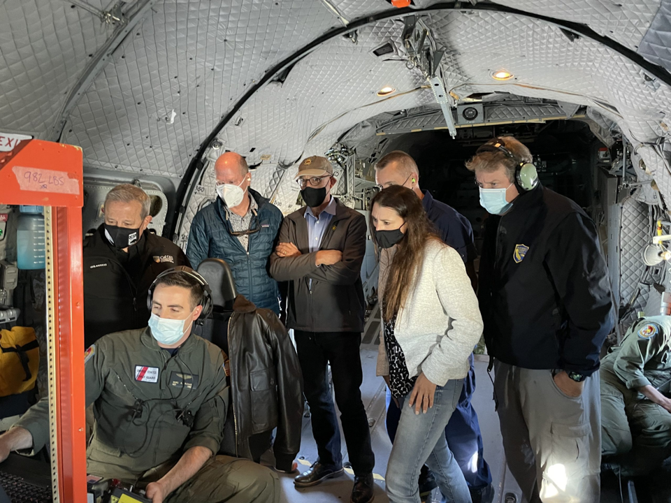
Oct 3, 2021 - Unified command was established to respond to the oil spill.
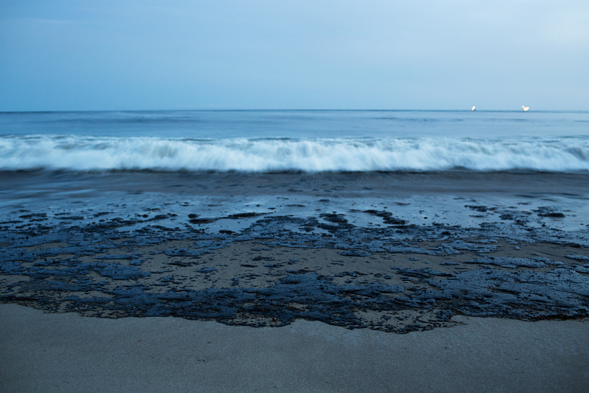
2015 Refugio Oil Spill—On May 19, 2015, an onshore pipeline just north of Refugio State Beach, CA ruptured, causing 101,000 gallons of crude oil to be released. Pictured: oil washed ashore in Santa Barbara, CA.
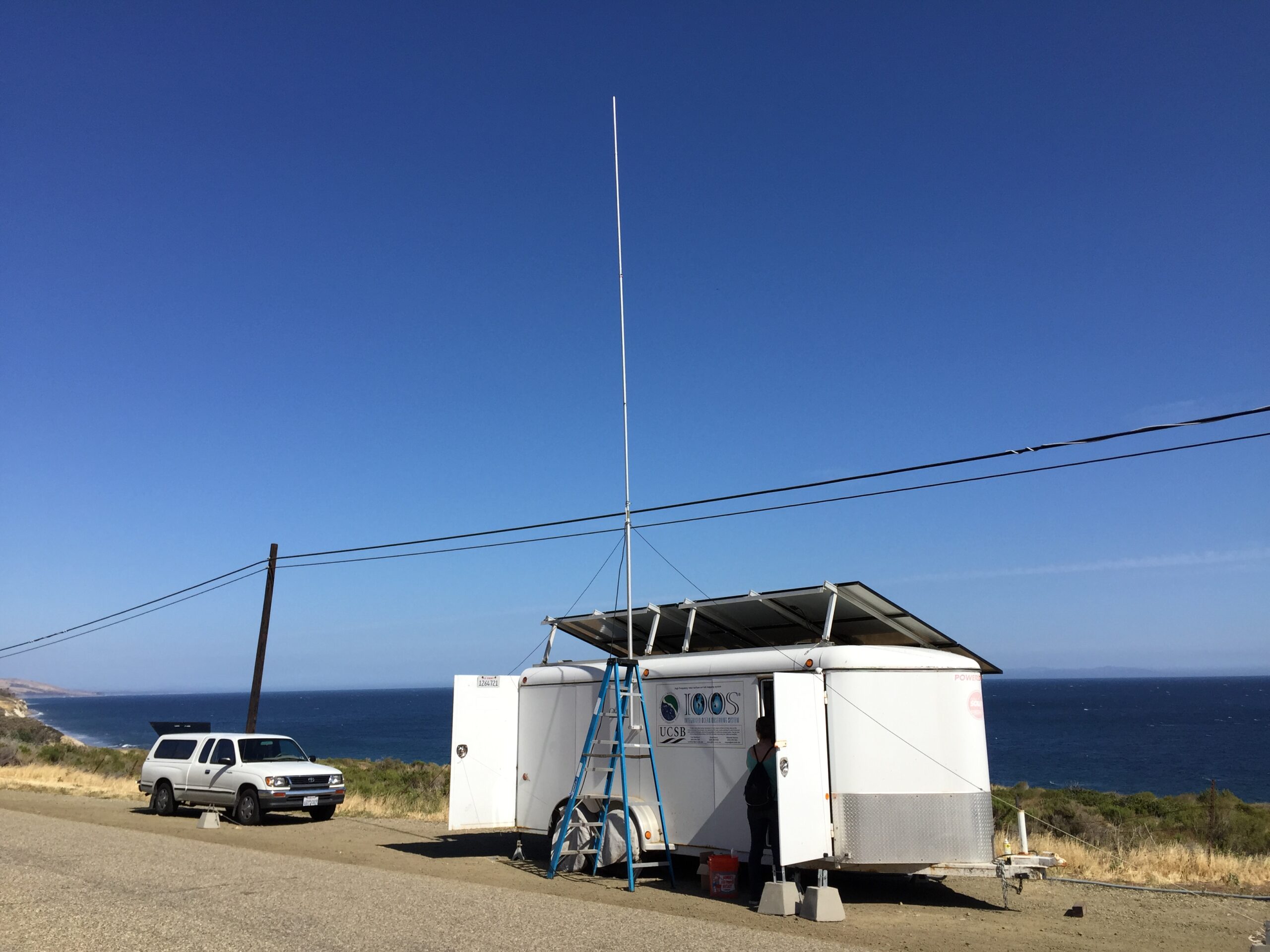
SCCOOS installed a temporary HFR near the Refugio spill site to fill surface-currents coverage gaps to improve oil spill trajectory models.
The State of California’s Oil Spill Prevention and Response (OSPR) team depends heavily upon offshore telemetry data from SCCOOS to guide our spill containment and clean-up operations. Interpreted primarily by a NOAA scientific support coordinator embedded in a response unified command, SCCOOS data, particularly the HFR network, was crucial in predicting the movement of oil on the ocean’s surface, enabling local communities to close and prepare their coastlines for the arrival of oil and clean-up contractors Oct 3, 2021 - Unified command was established to respond to the oil spill. Aerial photo of Tijuana River sewage plume in Feb. 2017 when 143 million gallons of raw sewage were discharged into the Tijuana River, contaminating San Diego County beaches. The Tijuana River Plume Trajectories and HFR-derived surface currents data are used daily by the County of San Diego, Department of Environmental Health and Quality, to help inform decisions on when water quality issues originating from Mexico may be impacting our beaches. Thanks to the information provided by SCCOOS, San Diego County can make better the best available trajectories of the oil to direct their resources. This importance and effectiveness of SCCOOS’ capability was most evident during the 2015 Refugio State Beach spill in Santa Barbara County and the 2021 Pipeline 000547 spill in Orange and San Diego Counties. CDFW OSPR most strongly recommends public and private support to allow SCCOOS to fund long overdue equipment sustainment and improvement upgrades to preserve this important resource that helps protect our vulnerable environment.
—California Department of Fish and Wildlife, Oil Spill Prevention and Response (CDFW OSPR)Coastal Pollution
Support trajectory plume models for coastal monitoring from surface current data
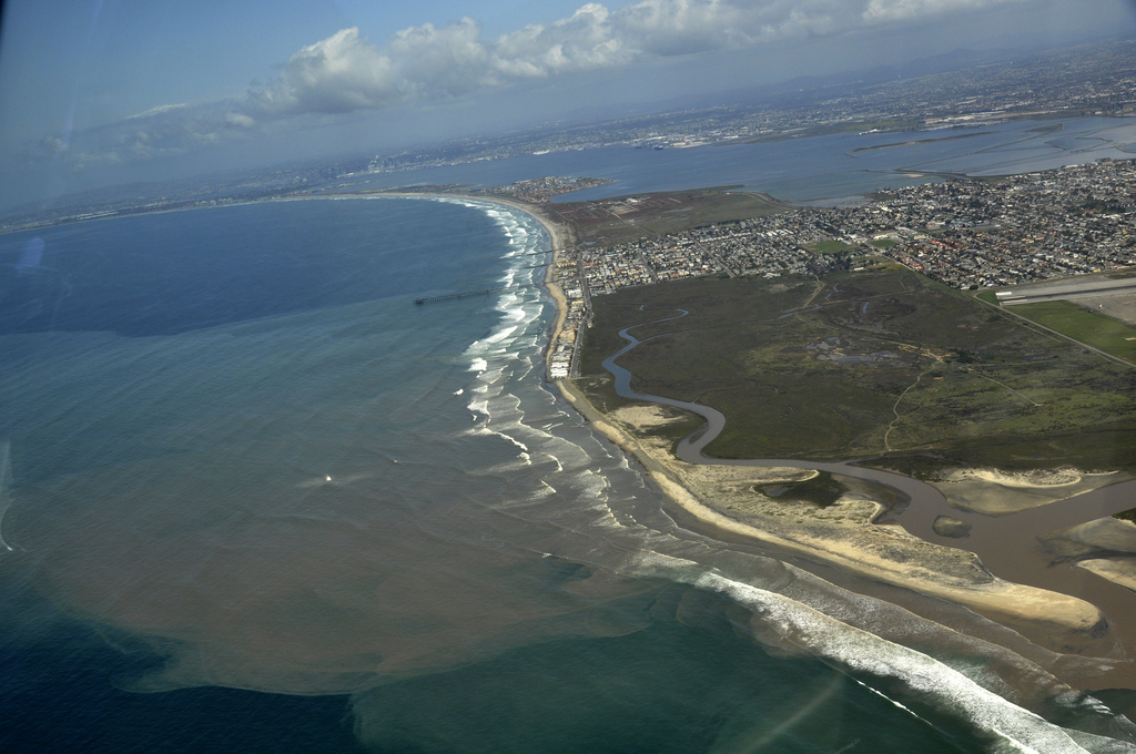
Aerial photo of Tijuana River sewage plume in Feb. 2017 when 143 million gallons of raw sewage were discharged into the Tijuana River, contaminating San Diego County beaches.
The Tijuana River Plume Trajectories and HFR-derived surface currents data are used daily by the County of San Diego, Department of Environmental Health and Quality, to help inform decisions on when water quality issues originating from Mexico may be impacting our beaches. Thanks to the information provided by SCCOOS, San Diego County can make better science-based decisions to protect the public health of beachgoers.
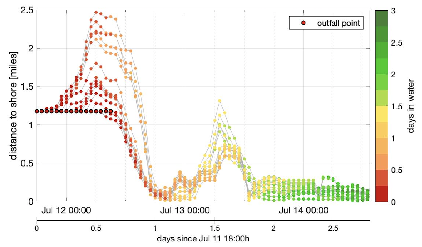
—Romina Schiess, Environmental Health Specialist III, County of San Diego, Beach and Bay Monitoring ProgramThe City of Los Angeles' Hyperion Water Reclamation Plant diverted the flow of its effluent (treated wastewater) from five miles offshore to one mile offshore in order to inspect the interior of the 5-Mile Outfall pipe in 2006 and eventually replace the Effluent Pumping Plant Header in 2015. SCCOOS HFR-derived surface current data and related particle dispersion models were extremely critical to the City of Los Angeles’ Environmental Monitoring Division adaptive monitoring and plume tracking effort during both the2006 and the 2015 events, the latter of which spanned nearly eight weeks, including pre- and post-diversion monitoring. In addition, on July 11, 2021, Hyperion needed to discharge 17 million gallons of untreated sewage through its 1-Mile Outfall during a flooding incident. The HFR data were extremely helpful in explaining the movement and dispersion of the plume and the absence of bacterial exceedances along the shoreline, even immediately in front of the discharge pipe.
—Dr. Mas Dojiri, Assistant General Manager, City of Los Angeles, LA Sanitation and EnvironmentHarmful Algal Blooms
Operate, sustain, and expand Harmful Algal Bloom (HAB) and phytoplankton community monitoring in support of a National HAB Observing Network
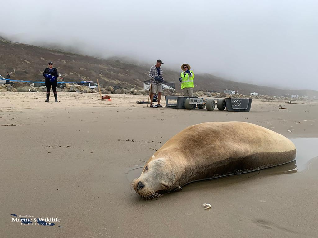
California sea lion displaying symptoms of domoic acid toxicosis and being rescued by CIMWI volunteers in August 2022.
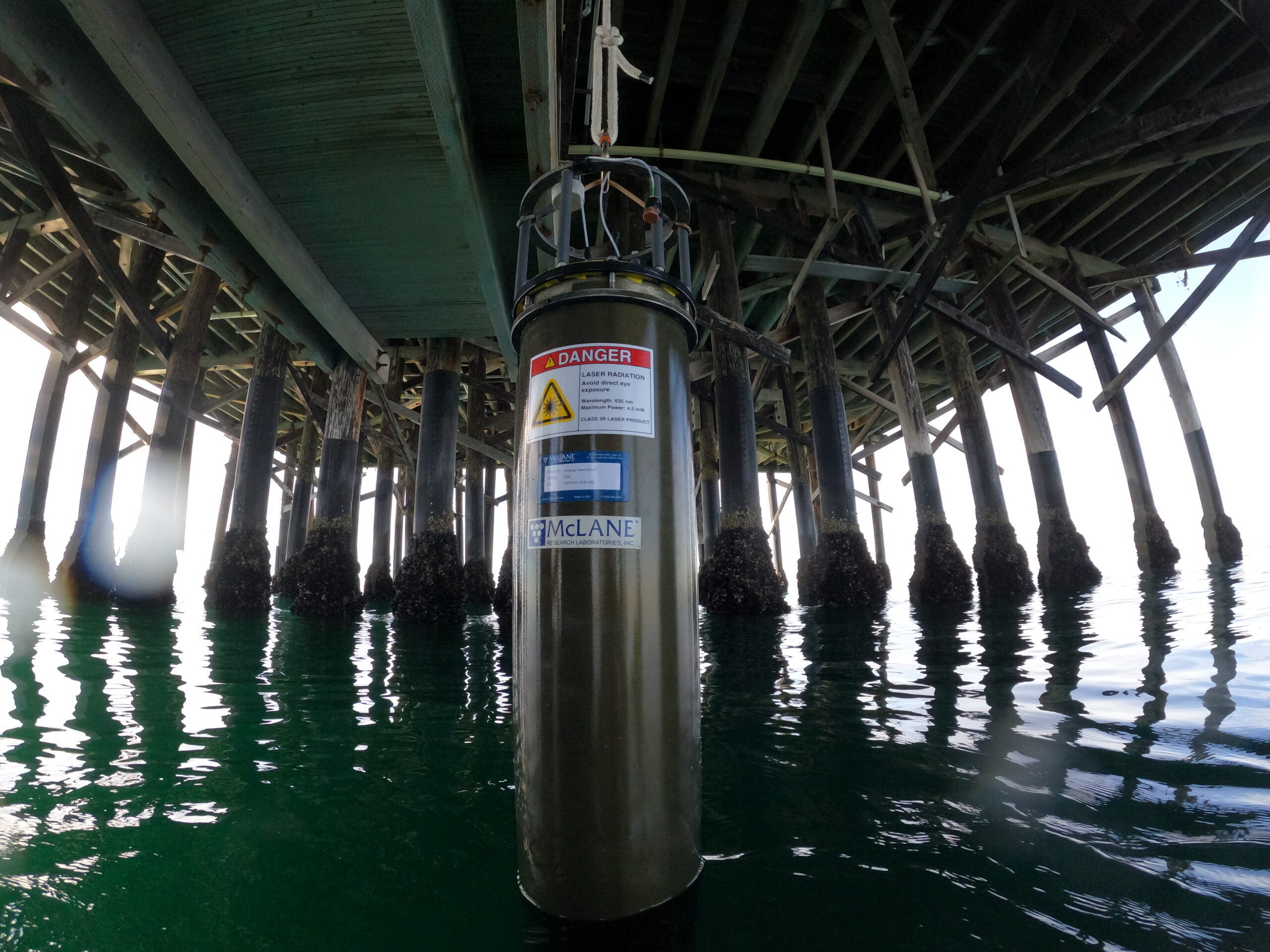
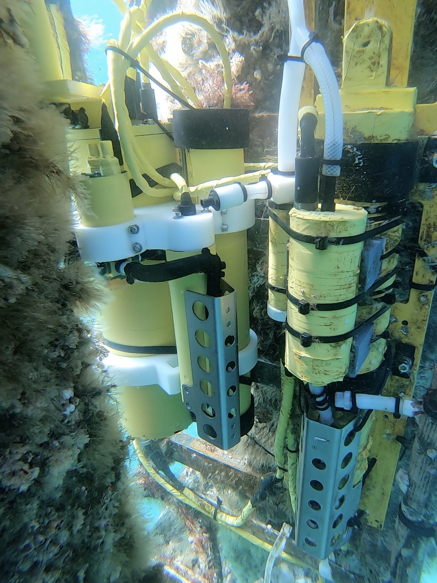
The Imaging FlowCytobot (IFCB) at Newport Beach Pier takes in situ photos of plankton and applies machine- learning algorithms to identify species in real time.
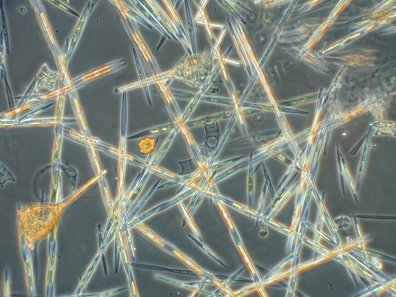
Pseudo-nitzschia, a diatom known to produce domoic acid, a potent neurotoxin that is harmful to marine mammals, seabirds, and humans.
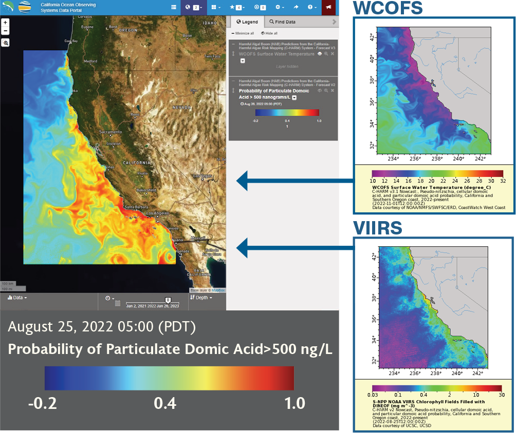
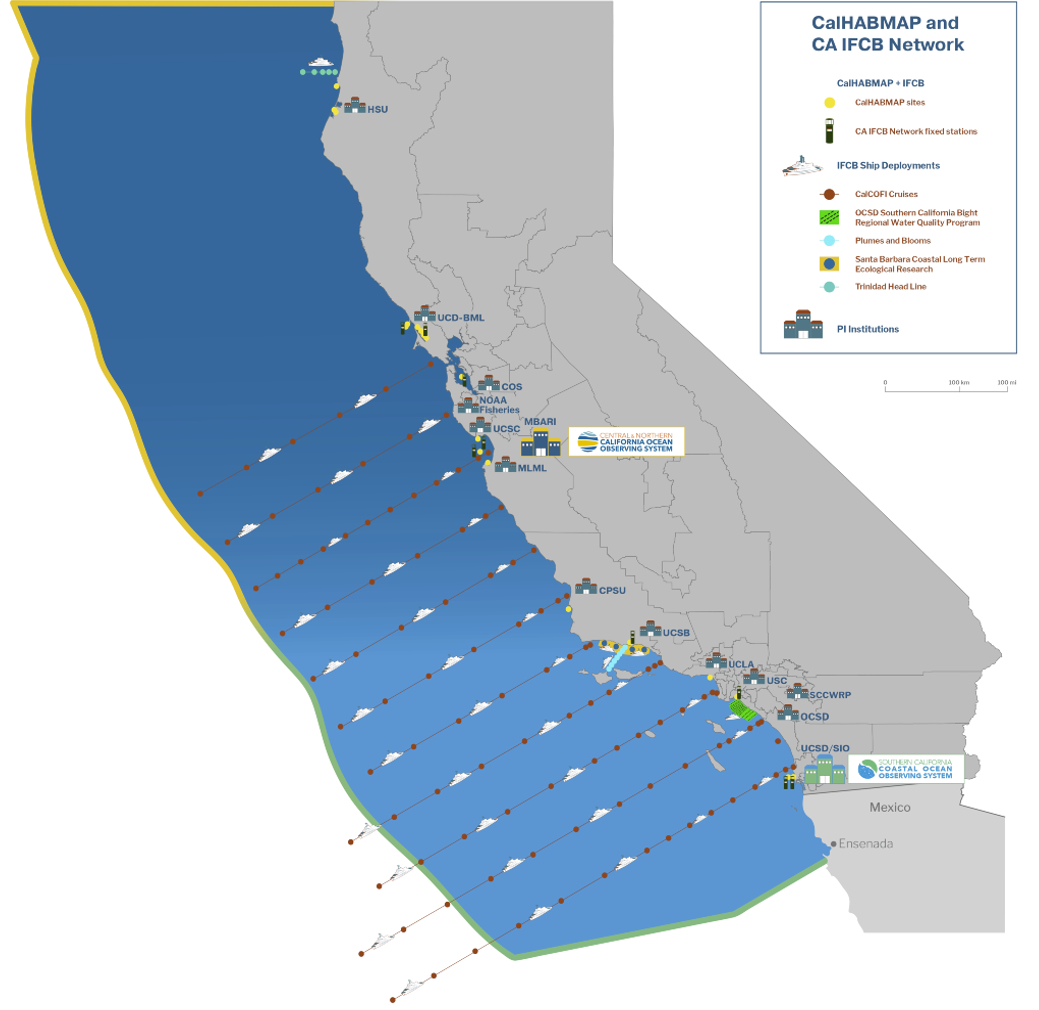
Channel Islands Marine & Wildlife Institute (CIMWI) uses SCCOOS harmful algal bloom data, C-HARM model, and CA HAB Bulletin to monitor domoic acid along the California coast in order to be at the ready to respond to marine mammals affected by increased levels of domoic acid. For example, CIMWI responded to 366 marine mammal strandings due to domoic acid toxicity in August and September 2022. CIMWI relied on SCCOOS during this time of crisis for alerts about C-HARM model predictions for particulate domoic acid, observations made by CalHABMAP and the CA IFCB Network, and in collaboration with other stranding centers in the state.
— Ruth Dover, Managing Director, Channel Islands Marine & Wildlife InstituteReal-Time Water Quality
Operate and sustain SCCOOS Automated Shore Stations in support of water quality management, HAB early warning, and public recreation
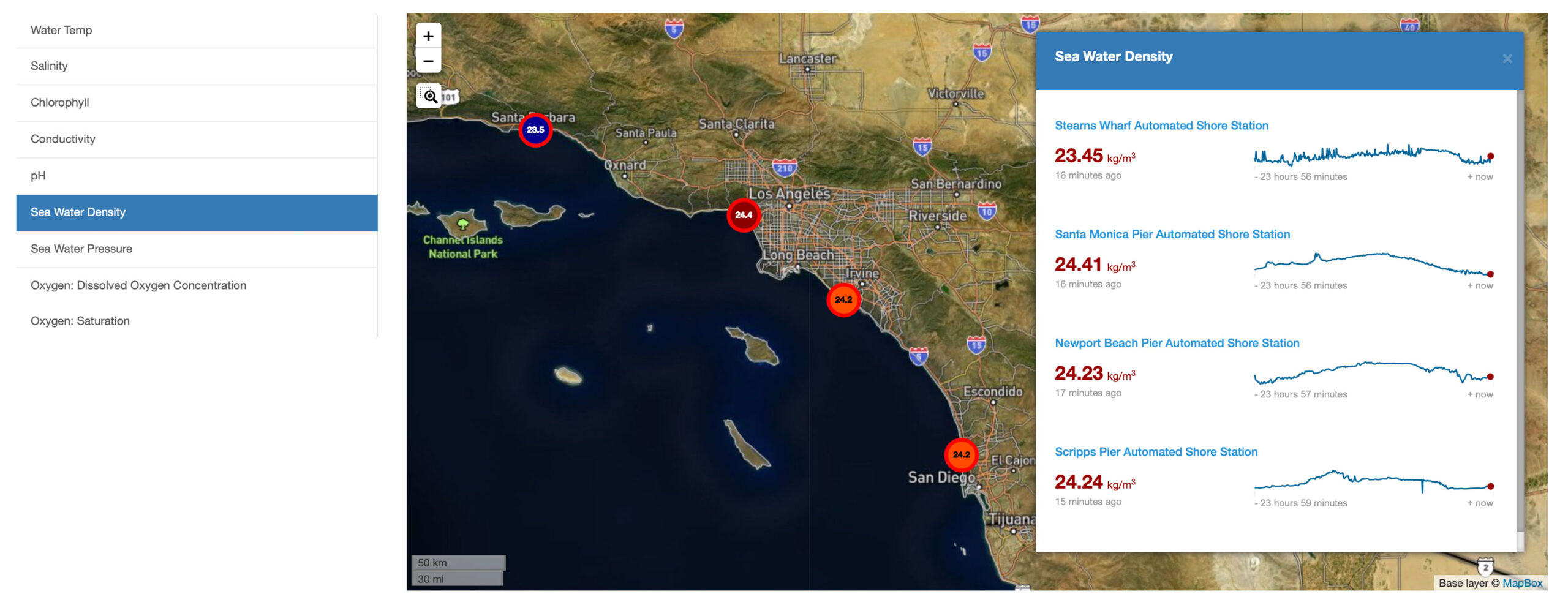
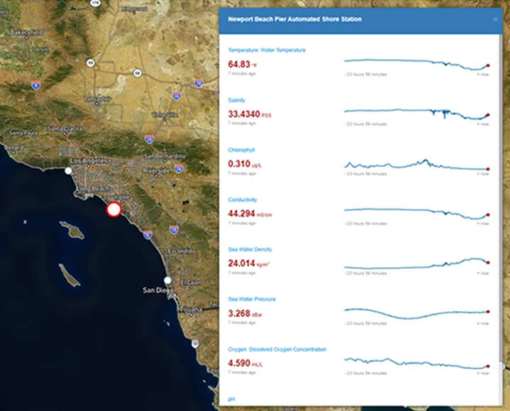
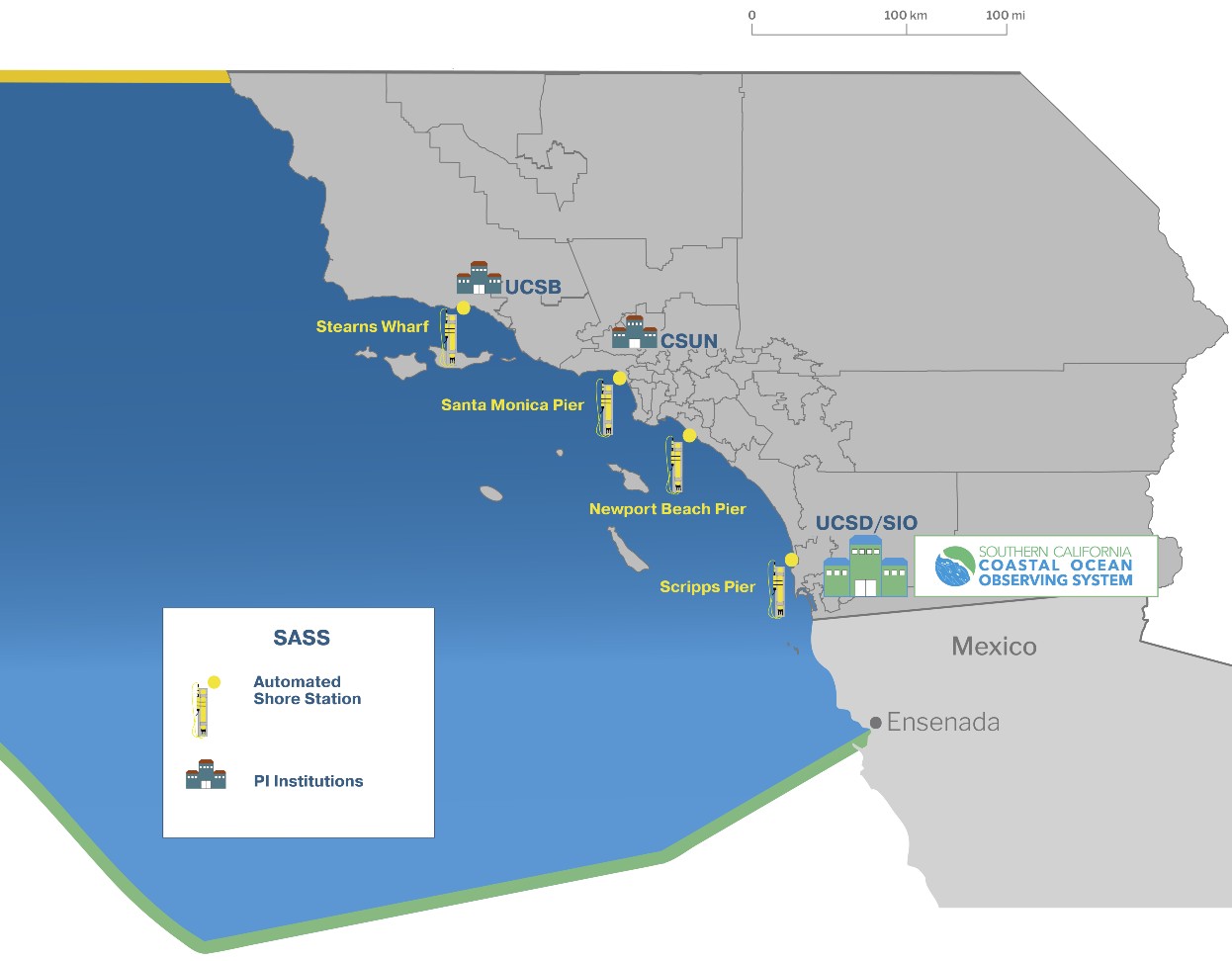
SCCOOS Automated Shore Station (SASS) dashboard. Since 2005, SCCOOS has measured a suite of Essential Ocean Variables (EOVs) at frequent intervals at four sentinel sites in the nearshore coastal ocean. These data provide local and regional information on mixing and upwelling, land run-off, and algal blooms.
SCCOOS’s Newport Beach Pier Automated Shore Station data are essential to OC San’s ocean monitoring efforts.The real time and historical observations contextualize our monthly water quality data on daily to decadal time scales. Knowing the variability present in our study area for oxygen, temperature, pH, and chlorophyll-a assists in discerning potential receiving water impacts from our ocean discharge.
— Laura Terriquez, Scientist, Orange County Sanitation DistrictOcean Acidification and Hypoxia
Integrate, operate, and maintain innovative sensors for monitoring pH and oxygen levels in support of water quality management and ecosystem monitoring
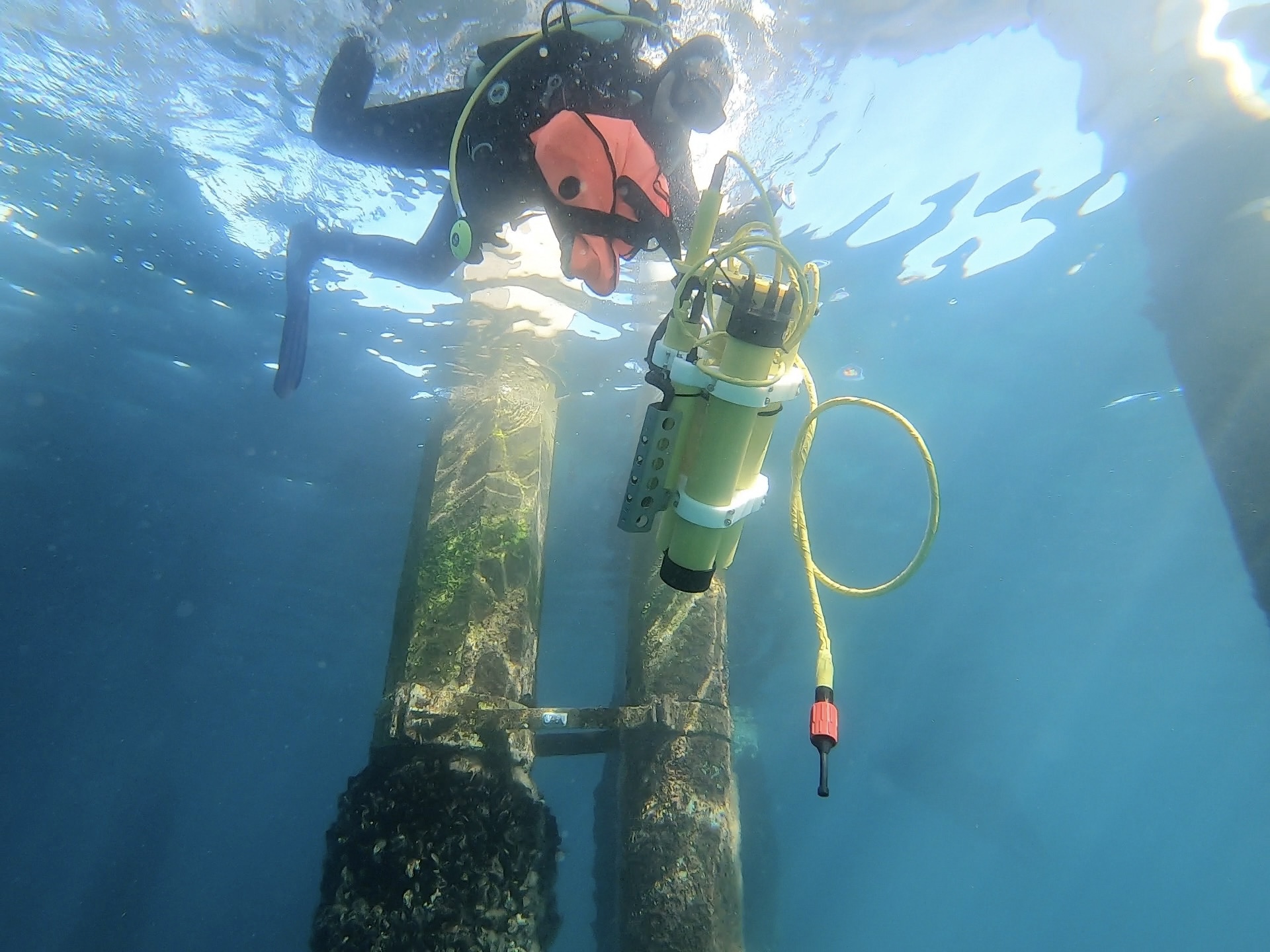
The Self-Calibrating SeapHox deployed at Scripps Pier is an emerging technology capable of conducting accurate and traceable calibrations in situ to monitor ocean acidification and hypoxia.
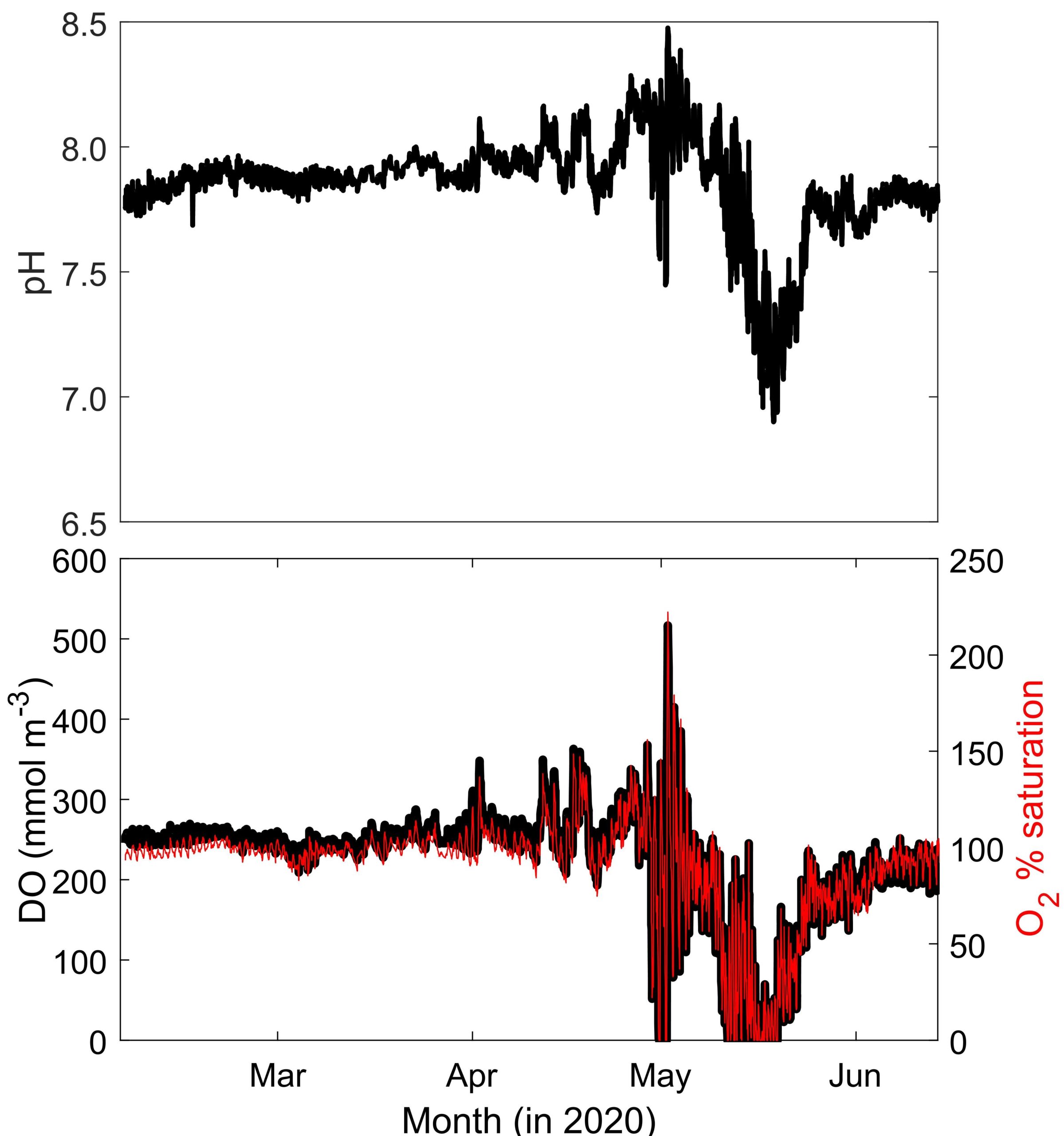
Following intense rain events in March and April 2020, the observed range of pH and Dissolved Oxygen (DO) increased dramatically with pH, reaching a maximum of 8.5 and a minimum of 6.9 in May. In connection with these extreme pH conditions, DO climbed to about 225% saturation, and fell to zero (anoxic) on several days. Figure modified from Shipley et al. 2022.
Climate change and human impacts continue to threaten our coastal and ocean ecosystems. Highquality and timely data is critical to making better natural resource management decisions. SCCOOS and CeNCOOS play a key role in providing information, in particular, in the areas of sea level rise, fate and transport of contaminant plumes, harmful algal blooms, and ocean acidification and hypoxia.
— Dr. Justine Kimball, Senior Climate Change Program Manager, Ocean Protection Council
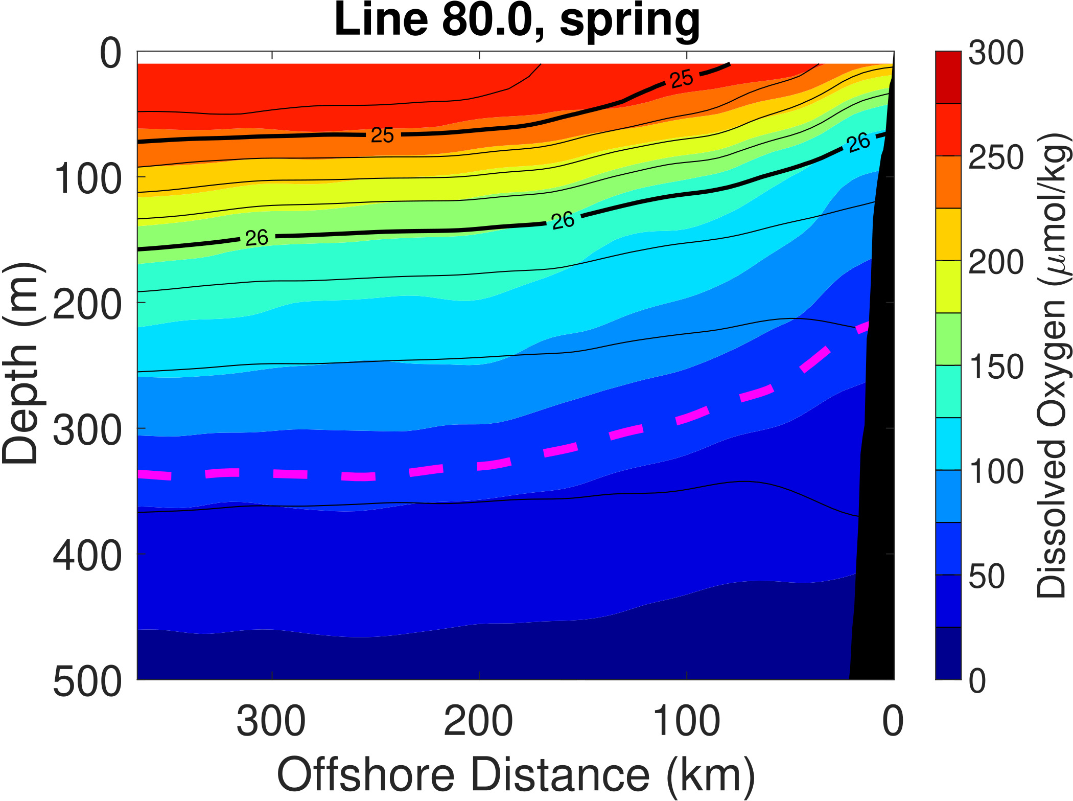
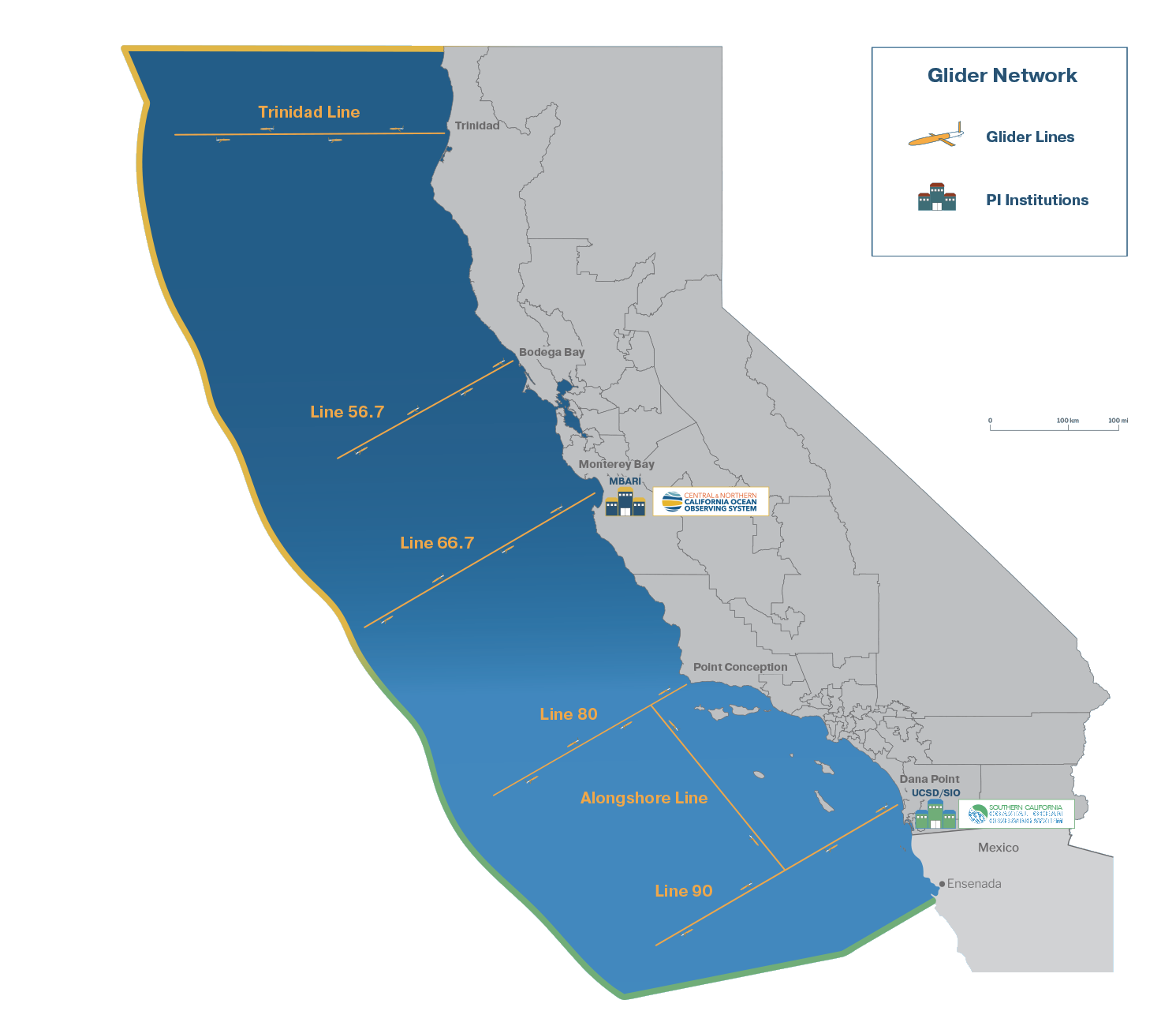
Average DO during the Spring (upwelling season) from the California Underwater Glider Network Line 80 off Point Conception, CA. The dashed magenta line is at 60 μmol/kg, which is one measure of hypoxia.
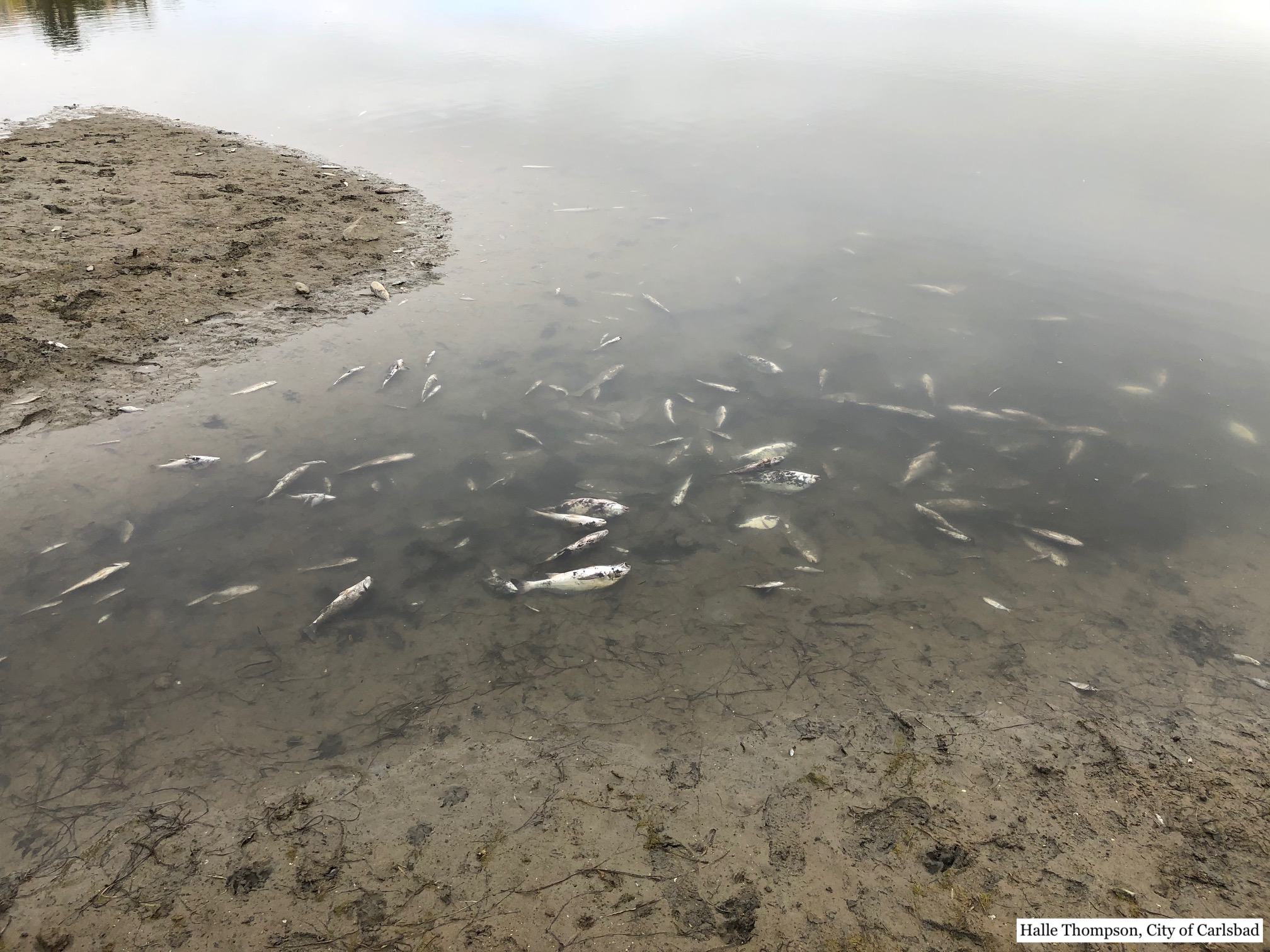
Dead fish observed at the Agua Hedionda Lagoon on May 1, 2020 due to low-oxygen conditions.
Aquaculture and Fisheries
Support resilient aquaculture farms and fisheries in a changing climate
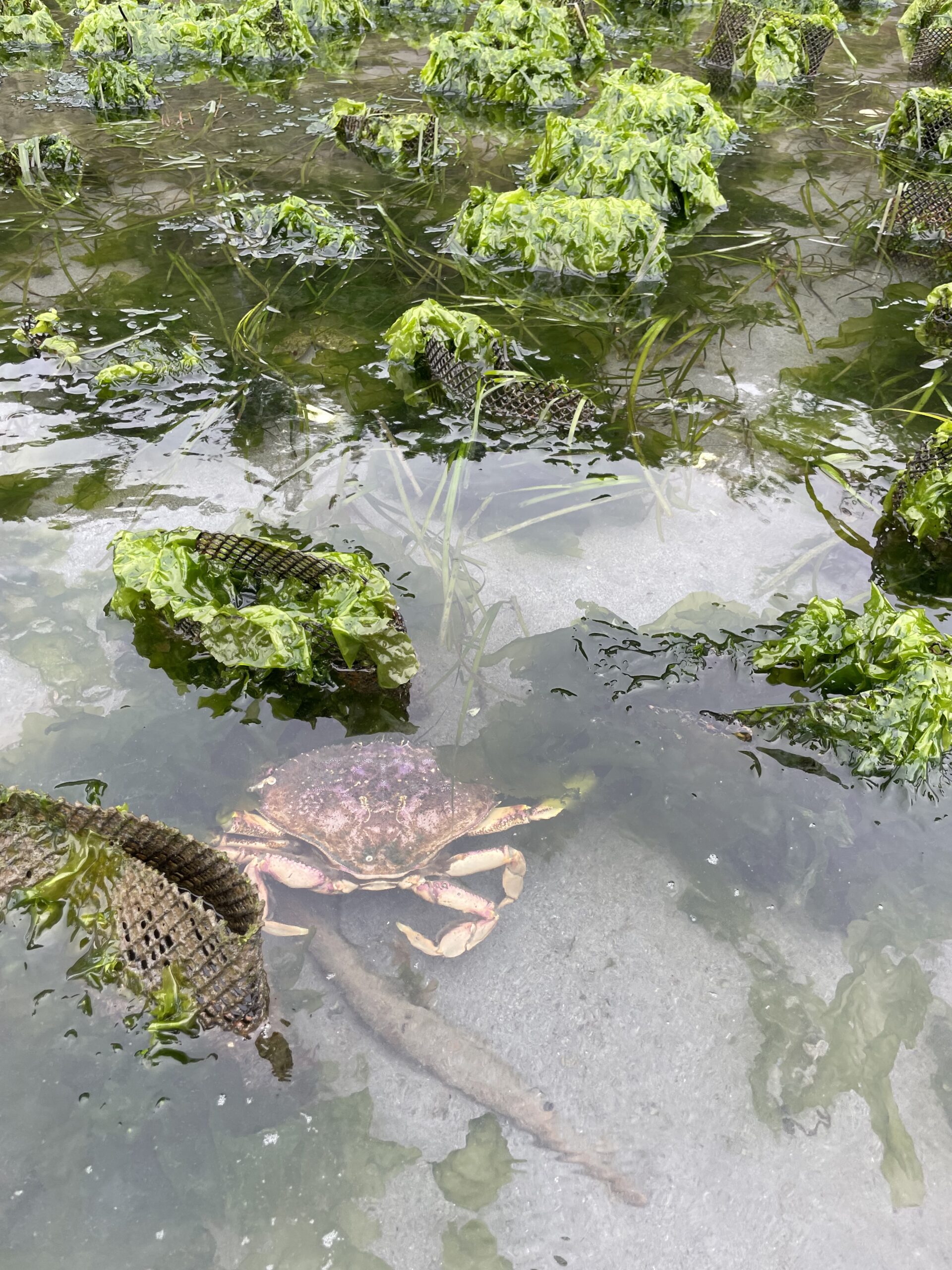
Dungeness crab finding refuge among mesh tubes in Discovery Bay at low tide.
Carlsbad Aquafarm has been sustainably farming shellfish since 1991. Our farm’s operating principle is “Restoration Aquaculture,” where priority is given to restoring the ecological health of the lagoon. We initiate and manage Living Shoreline Restoration projects in Southern California. The success of these projects depends on juvenile oyster settlement, which is impacted by changes in ocean chemistry and nutrient levels. SCCOOS real-time data are invaluable in providing highly dynamic ocean chemistry in establishing healthy oyster reefs in these vital estuaries and helping inform our farm’s shellfish operations.
— Thomas Grimm, CEO, Carlsbad Aquafarm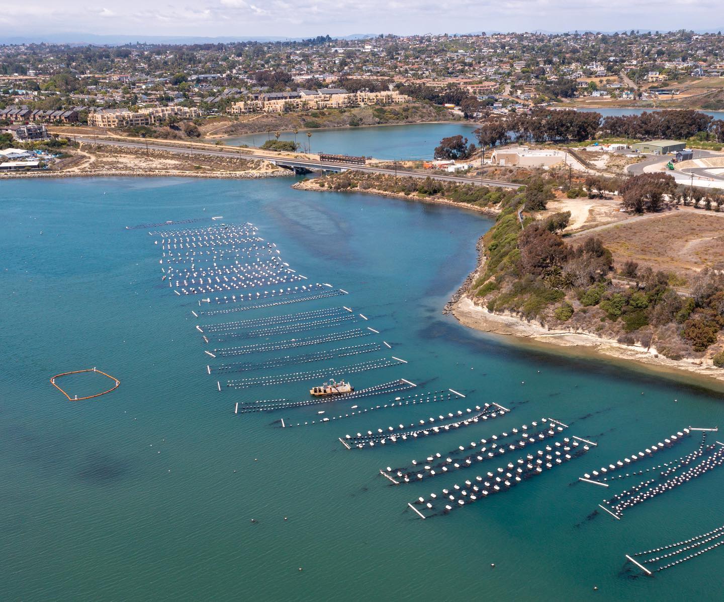
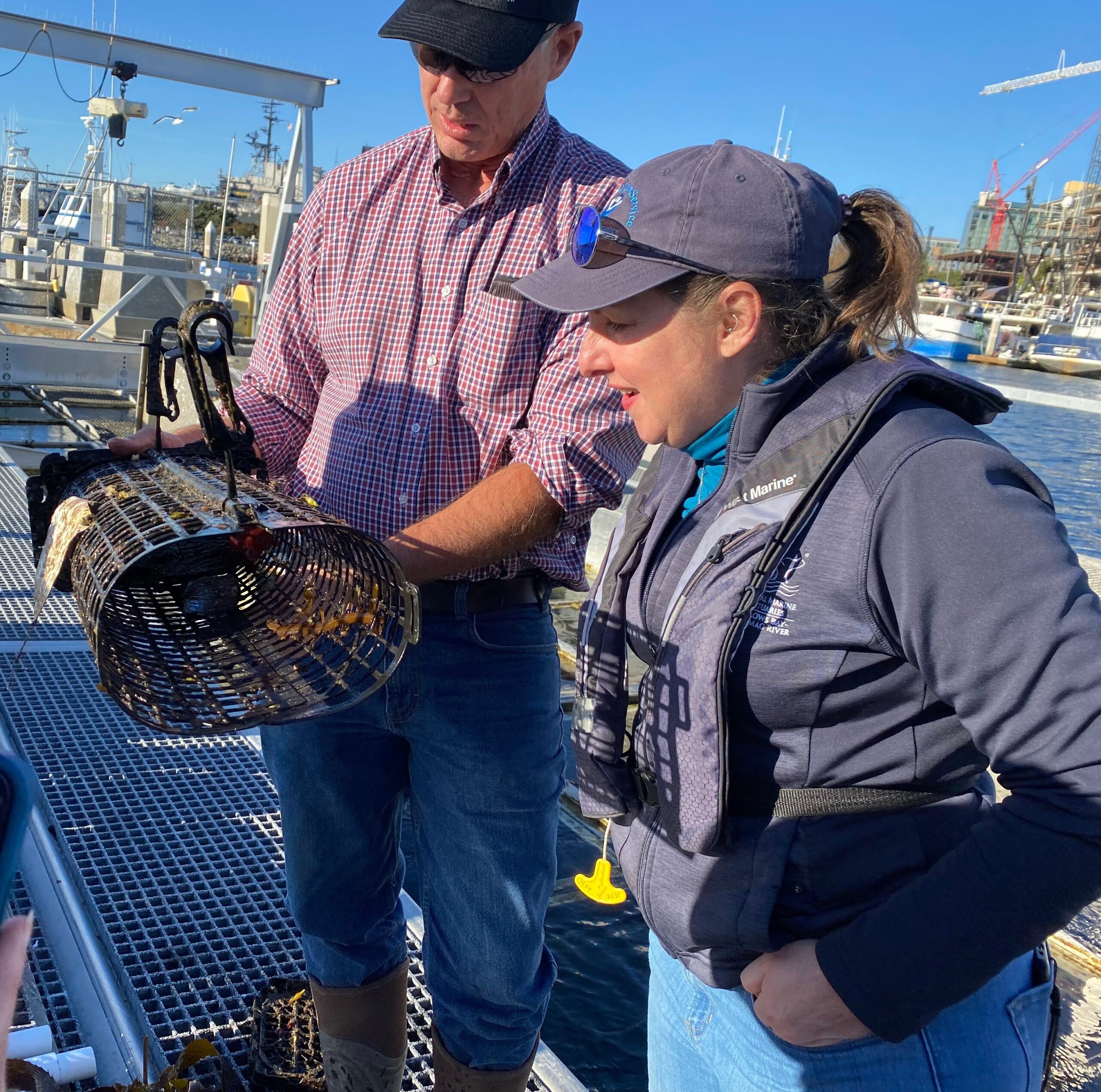
Nicole LeBoeuf, NOAA NOS Assistant Administrator, admiring a red abalone, a sea snail, grown at San Diego Bay Aquaculture using the Floating Upweller Nursery System technology (FLUPSY) at the Port of San Diego.
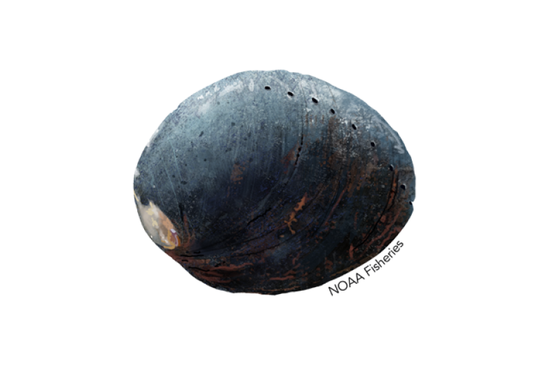
Close up of a red abalone
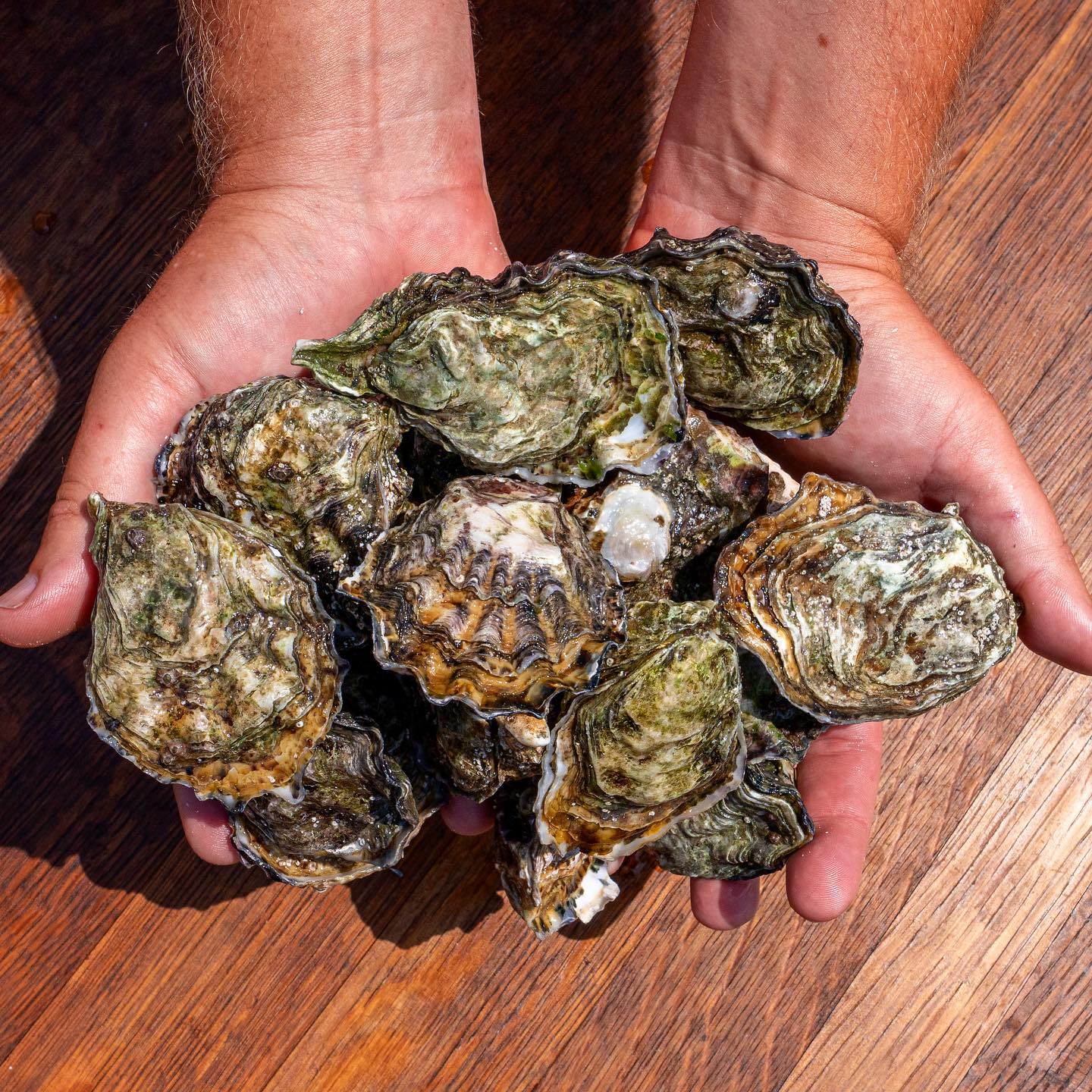
Pacific oysters cultured and harvested at Carlsbad Aquafarm.
Biodiversity and Ecosystem Health
Sustain, improve, and expand ocean observing time series of Essential Ocean Variables in support of science-based decision making
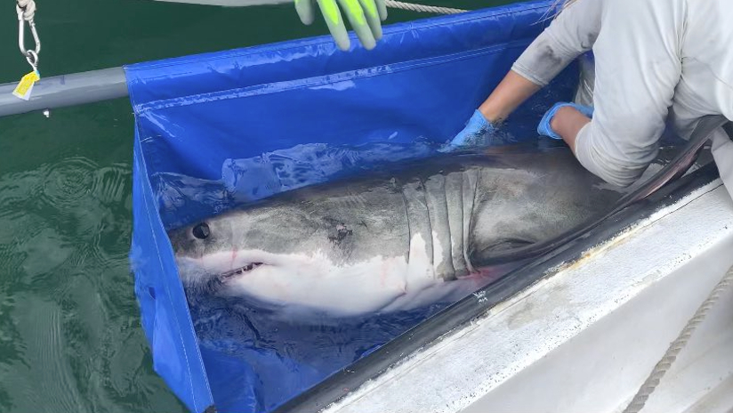
White shark tagged for acoustic telemetry monitoring.

Brandt's Cormorant in breeding plumage, a resident species observed during at-sea surveys off the California coast.
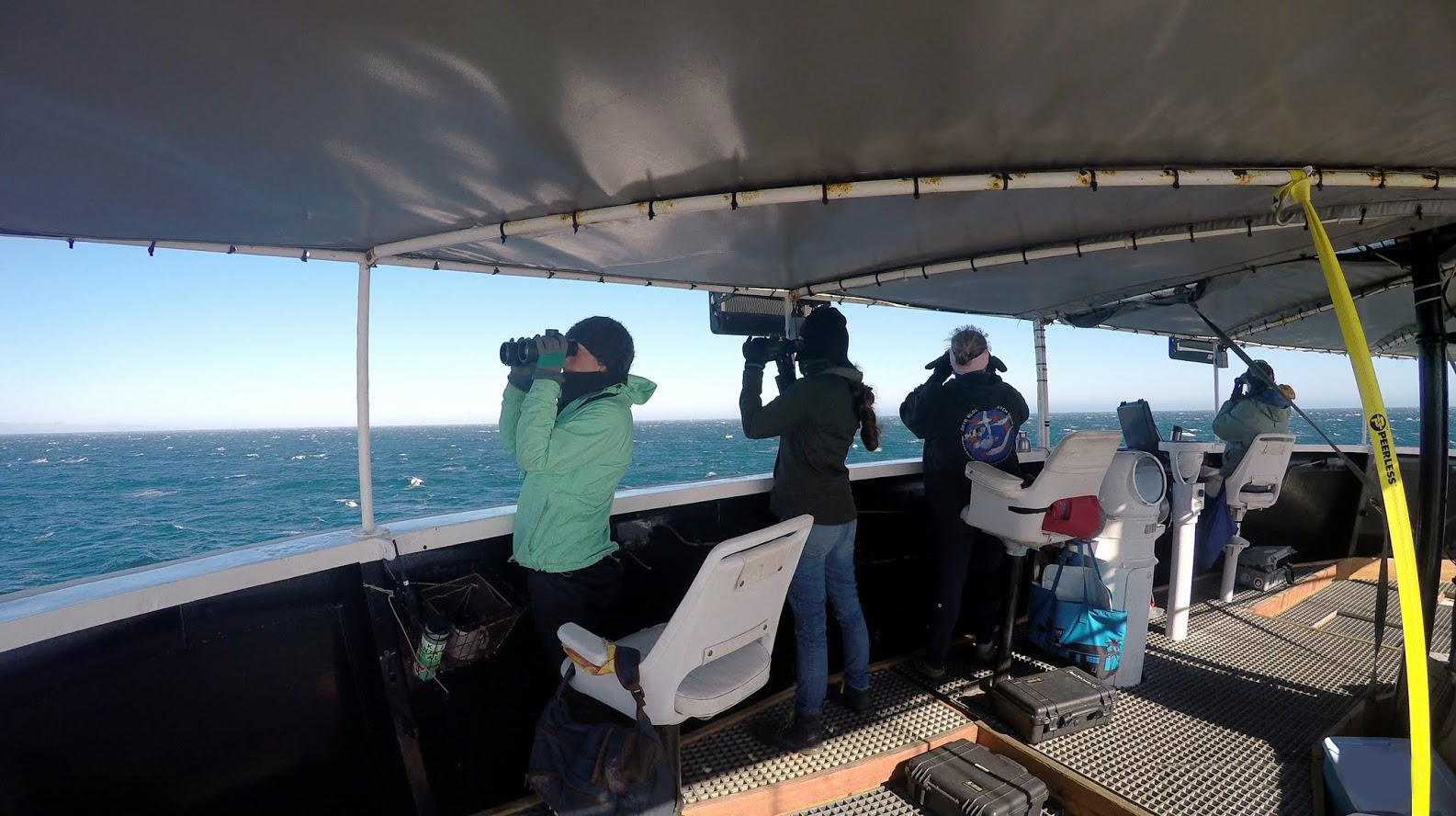
Seabird and marine mammal monitoring along the California Cooperative Oceanographic Fisheries Investigations(CalCOFI) transect.
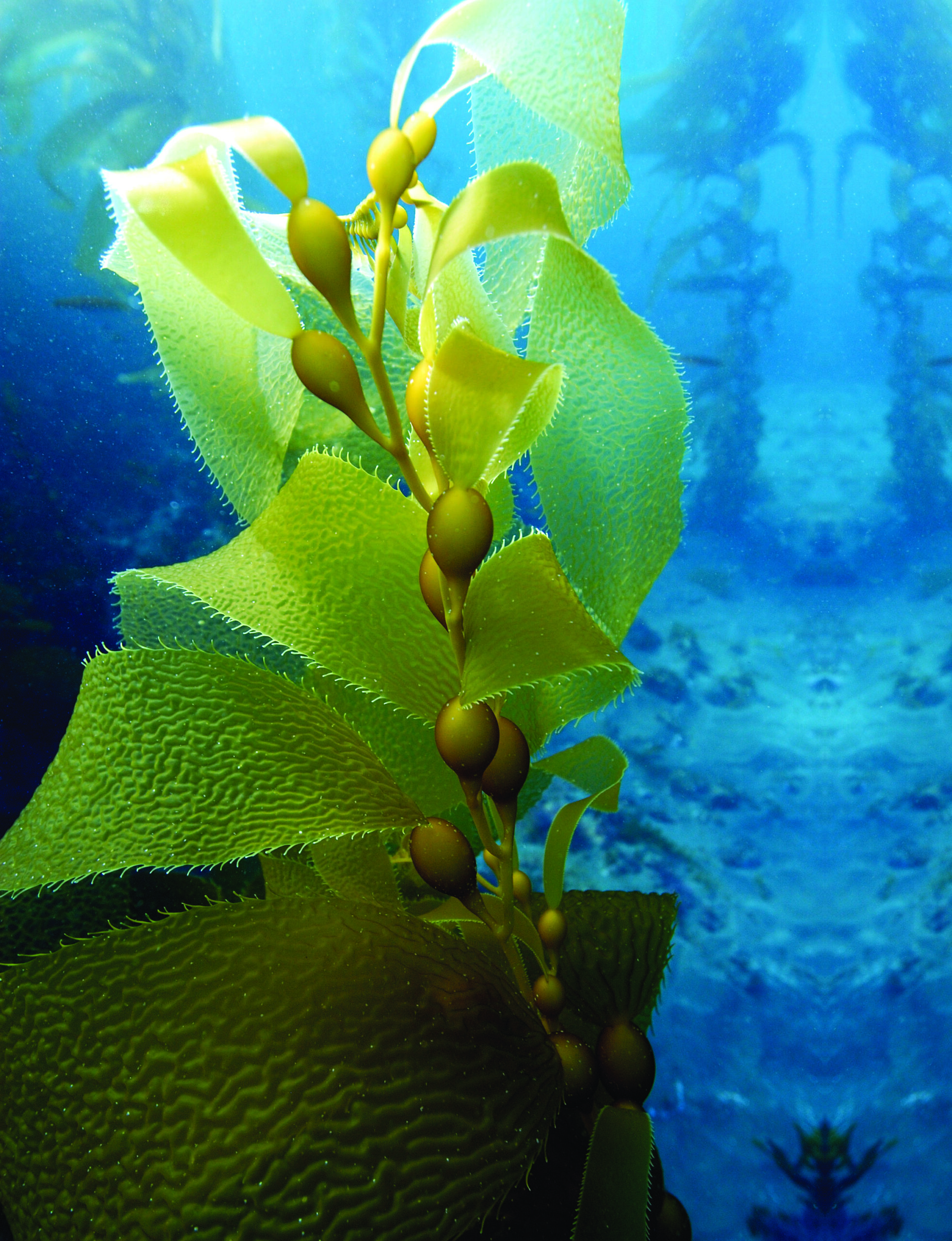
Giant kelp
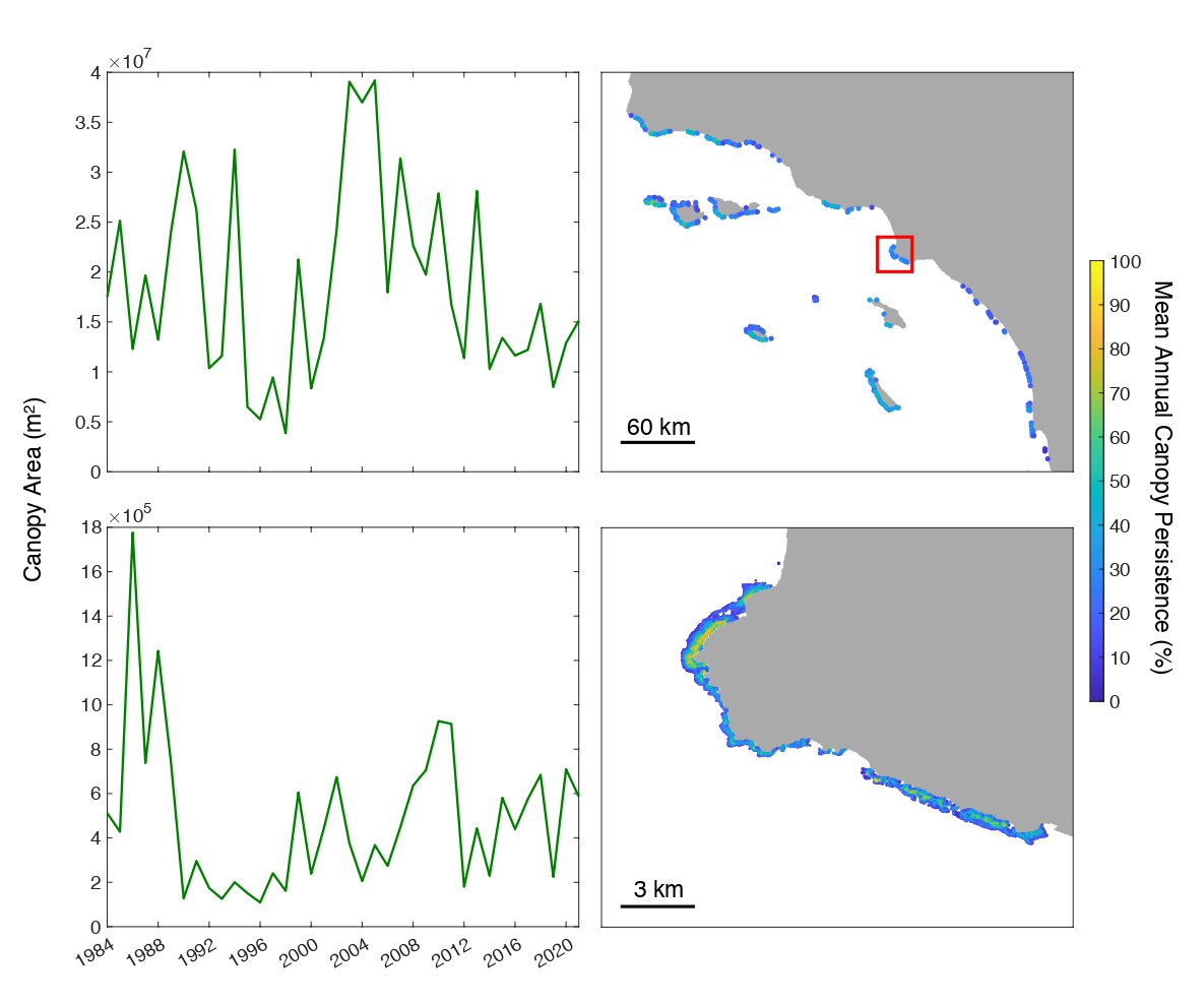
As the Channel Islands National Marine Sanctuary faces new and unprecedented stresses associated with a changing climate we rely more than ever on the data services provided by SCCOOS. Synthesized and scaled data products showcasing larval fish abundance and kelp canopy cover coming from the regional CalCOFI cruises and Dr. Tom Bell’s research respectively have been essential in enabling us to track biodiversity and overall ecosystem health.
— Chris Mobley, Superintendent, Channel Islands National Marine SanctuaryMarine Heat Waves
Operate, sustain, and expand the California Underwater Glider Network in support of a climate ready nation
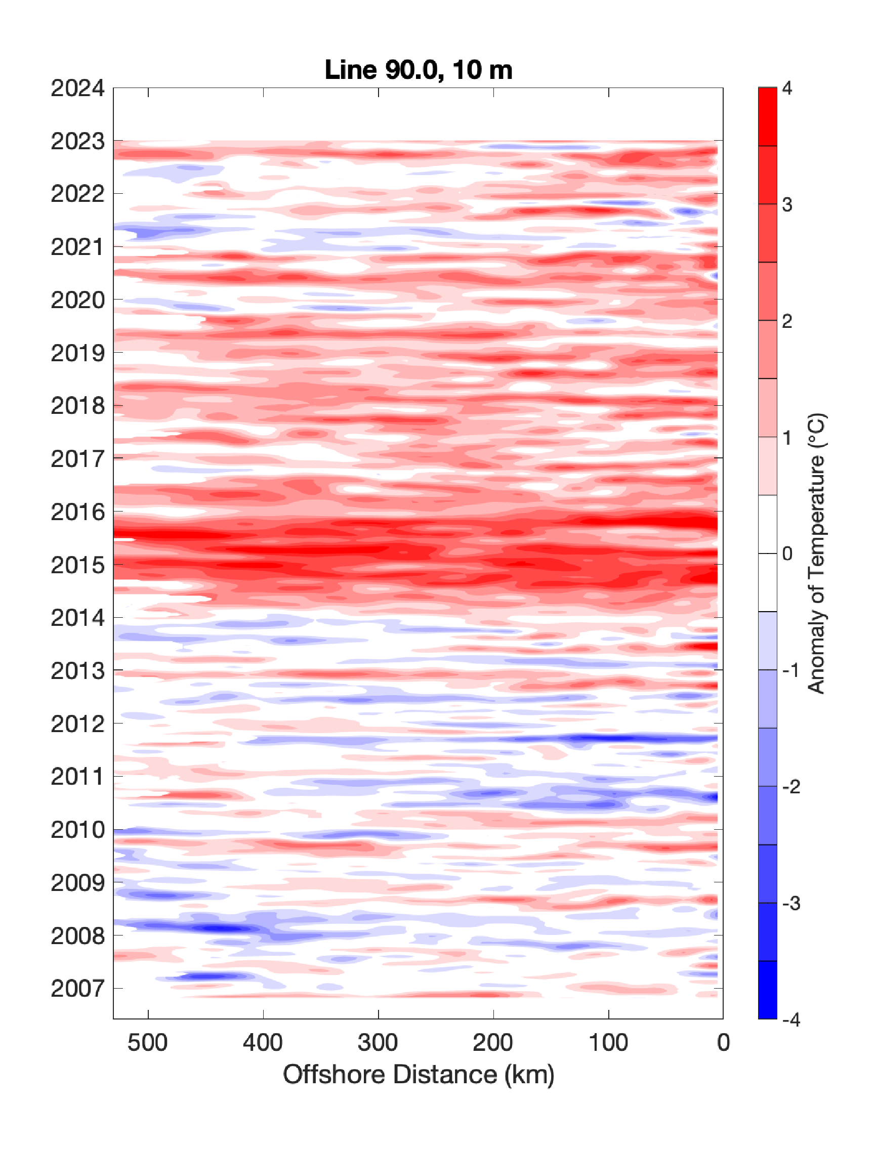
Oceanic marine heat waves and El Niño/La Niña cycles are two aspects of oceanic variability that have a significant impact on west coast marine ecosystems. Long-term, high-quality, and near real-time monitoring of this variability supported by the SCCOOS and CeNCOOS California Underwater Glider Network provides information to NOAA NMFS managers and decision-makers for protecting the environment and utilizing resources.
—Dr. Toby Garfield, Director, Environmental Research Division, Southwest Fisheries Science Center, NOAA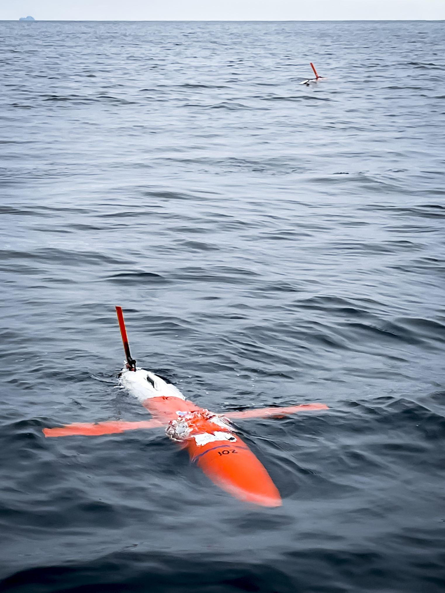
Generation 2 Spray glider in the foreground on the SCCOOS alongshore transect. In the background is an original Spray glider with its wing up for satellite communication.
Sea Level Rise and Coastal Inundation
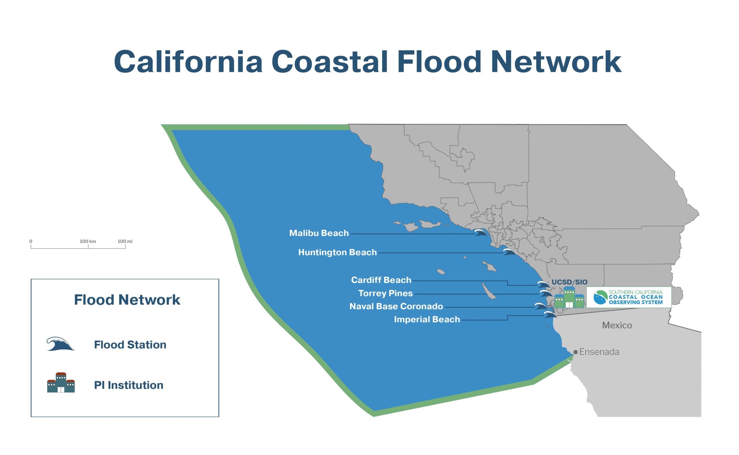
Support and expand the California Coastal Flood Network in response to sea-level rise and coastal inundation
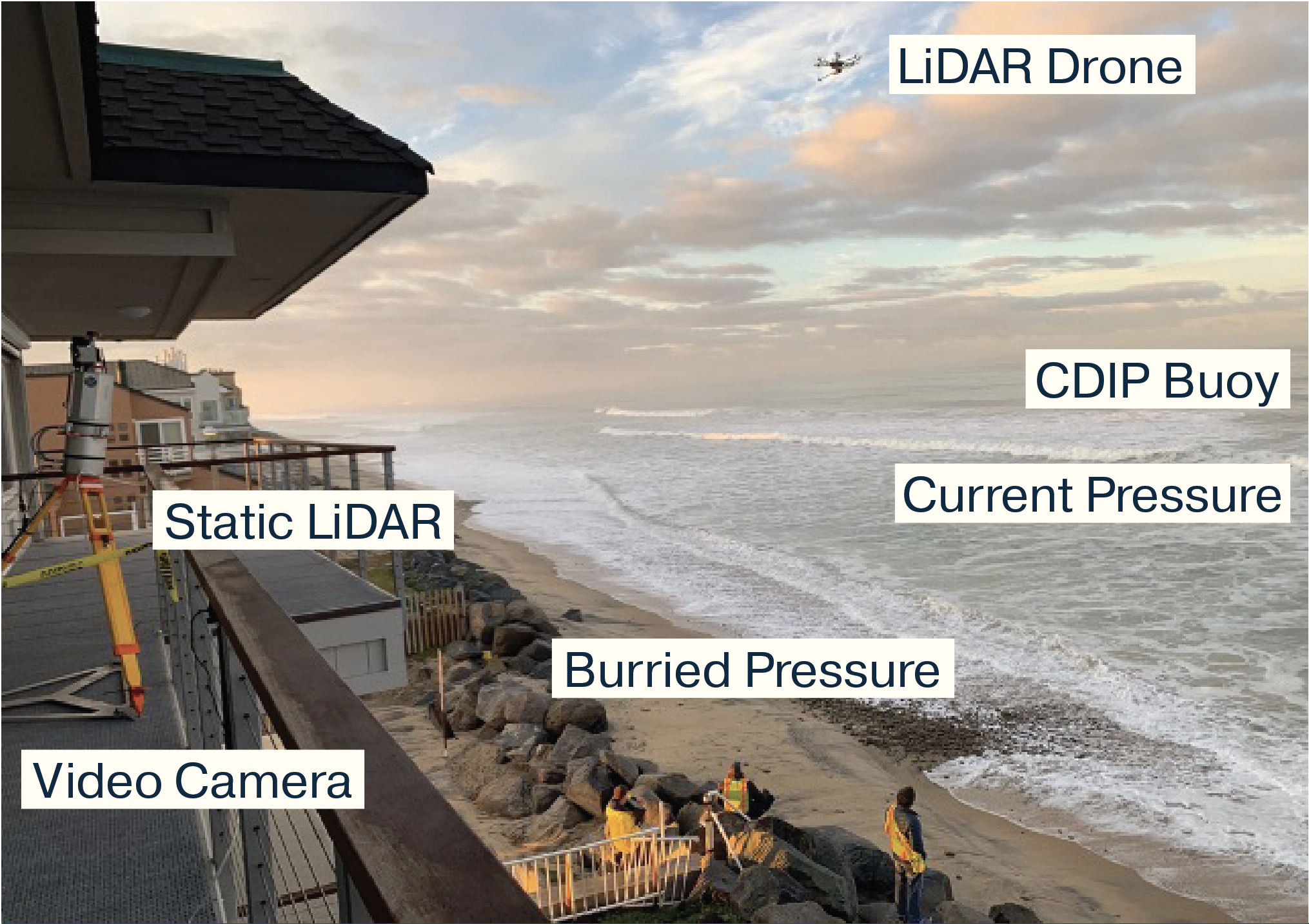
Technology used to improve wave run-up predictions.
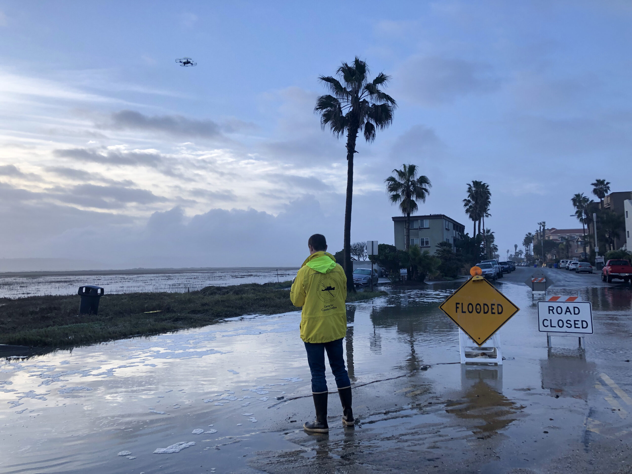
Drone recording flooding at Imperial Beach, CA.
The City of Imperial Beach is grateful for SCCOOS data, models, and products that enables the region to navigate complex coastal management issues. The monitoring data from SCCOOS are critical to several important issues that directly impact the City of Imperial Beach, which include protecting public health from the pollution crisis in the Tijuana River, modeling the transport of beach sand along the shoreline, and implementing a new California Coastal Flood Network to notify residents and emergency responders before coastal flooding events. SCCOOS is a powerful tool that helps the city prepare and respond to the unique challenges along the Imperial Beach shoreline.
—Serge Dedina, Mayor, City of Imperial BeachTowards the Next Generation
End-to-End Coastal Ocean Observing System
Build out sensor suites on fixed and mobile platforms, complemented by new biological and ecological monitoring approaches, including eDNA, animal telemetry, and ocean sound
As demonstrated, SCCOOS has spent the last decade building robust infrastructure for ocean observing that establishes platforms for biophysical parameters. It cannot be overstated that these flagship capabilities were developed by implementing and highly leveraging regional capacity in marine science, ocean observing, and prediction. While the California ocean observing systems have successfully evolved to support critical marine operations and ecosystem monitoring, there is ample motivation to expand to meet the needs of a growing Blue Economy bolstered by California’s living marine resources.
SCCOOS is strategically contributing to the priorities articulated in the implementation plan of the UN Decade of the Oceans, the UN Sustainable Development Goals, and the OceanObs’19 decadal directive to sustain physical, biogeochemical, and biological observations that maximize societal benefit. The SCCOOS future vision is a regionally relevant system -- in close collaboration with our partner CeNCOOS -- that monitors IOOS Core Variables and ecosystem dynamics, from physics to biogeochemistry to biology, while serving the needs of existing and future stakeholders from government agencies, the private sector, and underserved communities, to leading national researchers. By engaging industry to fill critical observing gaps, SCCOOS is establishing a forward-thinking network for the next decade and beyond that benefits California, the nation, and the global ocean observing community.
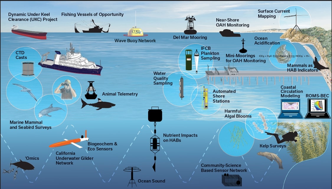
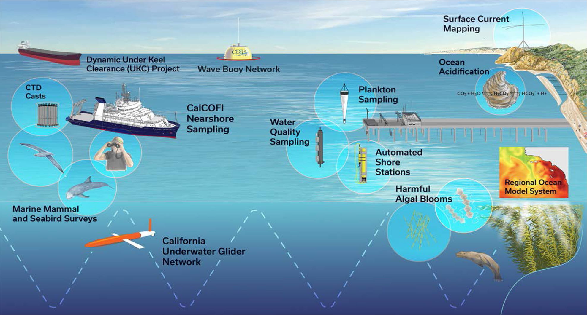
Illustration of SCCOOS regional funded projects (colored icons) and unfunded projects (black icons) proposed in SCCOOS FY21-26 proposal.

